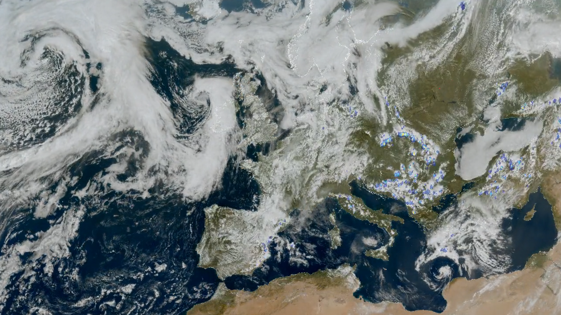
Image of the week: Lightning from space
Watching our Earth

MTG-S1 launching
This year Meteosat-12 will be joined by the new Meteosat Third Generation sounding satellite (MTG-S1), the first ever European sounding satellite in geostationary orbit.
MTG-S1 will carry two missions: the Infra-Red Sounder (IRS) and the Copernicus Sentinel-4 Ultraviolet-Visible-Near-Infrared light imaging spectrometer (UVN).
In combination with data from Meteosat-12, MTG-S1 will enable weather and climate scientists to get a 4D vision of the dynamics and composition of the atmosphere.
Follow the journey to the launch of the satellite on our launch hub
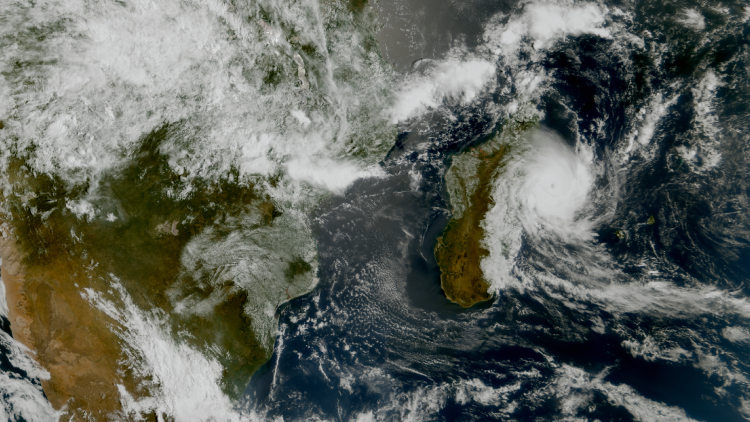
Lightning from space
The image shows data from both the FCI and LI on Meteosat-12 on 22 April 2025.
See imagery from Meteosat-12 live on our Earth view stream.
More info
Learn more about Meteosat satellites
Visualise Meteosat-12 data with EUMETView
Access weather data from the EUMETSAT User Portal