A team sport
Satellite instruments work together to provide a comprehensive view of sea level rise across the globe

In advance of the launch of Copernicus Sentinel-6B later this year, Lead Marine Applications Expert Dr Hayley Evers-King provides insight into this mission, crucial for measuring sea level rise.
14 November 2025
13 November 2025
Sea level rise is an urgent problem.
From 1901 to 2018, the average sea level across the globe rose by 0.2 metres, with the rate of sea level rise accelerating. Sea level rise endangers people in low-lying coastal regions in many ways. It exacerbates flooding and erosion, contaminates aquifers with saltwater, and can cause formerly livable areas to become completely submerged.
In advance of the launch of Copernicus Sentinel-6B later this year, EUMETSAT Lead Marine Applications Expert Dr Hayley Evers-King explains why it is so important to measure sea level from space, the singular role this mission plays as the reference for all other instruments of its kind, and why it is so important to continue to collect precise measurements of sea level rise.
Why not just measure the sea level from the Earth’s surface?
Although land-based instruments are very useful for measuring sea level, they do not tell the whole story. The main way sea level is measured at the surface is by using tide gauges, instruments that are fixed to land along the coast, so they do not give us any information about what the sea level is like in the middle of the ocean. In addition, tide gauges are concentrated near big cities, with more in the northern than the southern hemisphere.
Credit: ESA
You might think, well, water levels out, so the sea level must be the same throughout the ocean, but this is actually not true. Because of the way the Earth rotates, the oceans circulate, the effects of gravity, the effects of latitude, and the driving of the winds, the sea surface is actually really lumpy. Really the only way to capture this sort of dynamic variability in sea level is by using satellite instruments, which can get a whole global picture of ocean height at regular intervals. We need the spatial and temporal resolution that satellite altimeters, instruments that measure sea level from space, provide.
How do altimeters work?
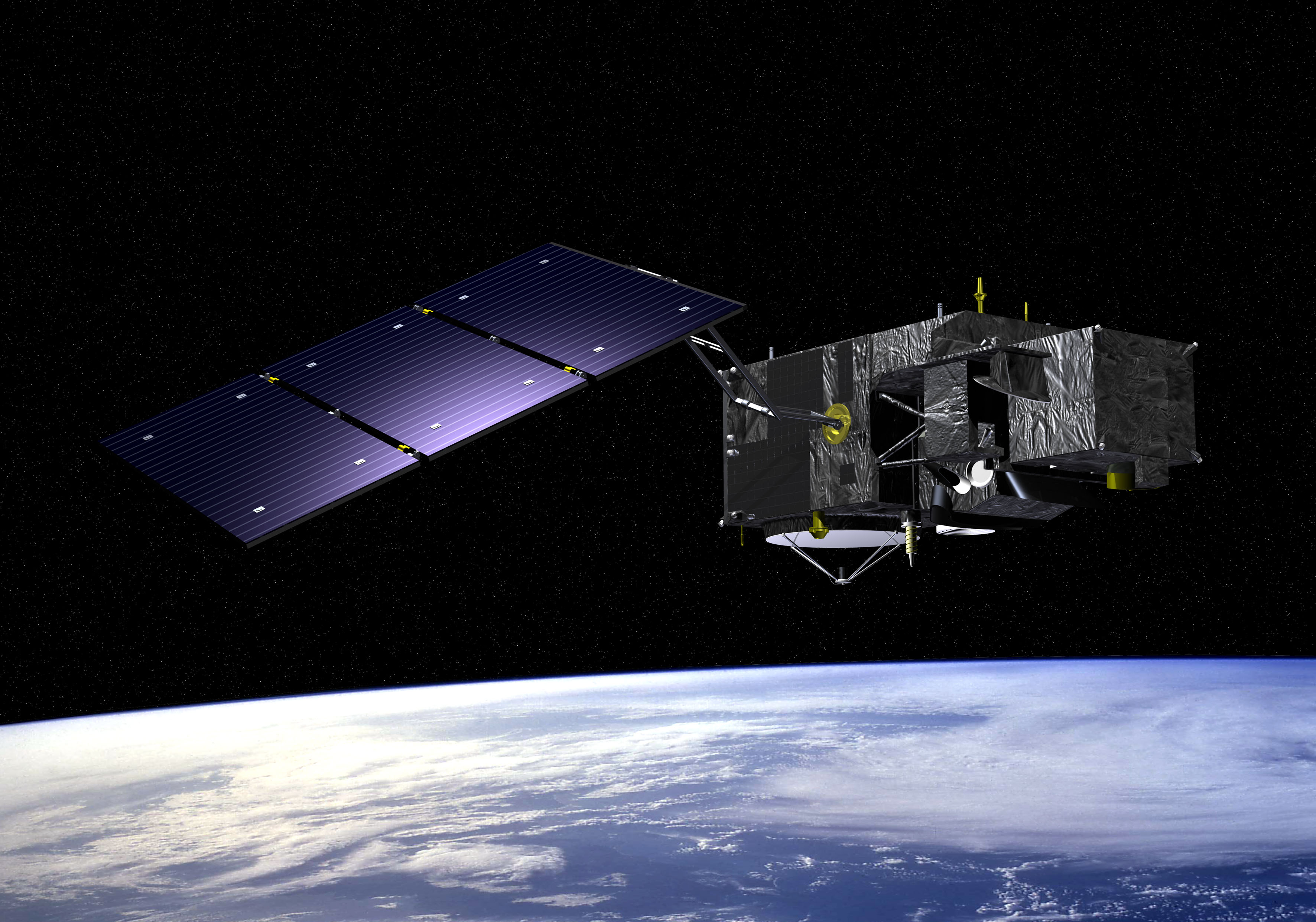
Altimeters are interesting instruments because they are quite different to a lot of the other instruments that we typically work with. They are an active instrument, meaning they create a signal of their own that they send down to Earth and wait to receive back. The instrument in space sends down a radar pulse. It travels down through the atmosphere to the ocean, interacts with the surface of the ocean, and is reflected back up towards the satellite.
The question is: how long does it take for the pulse to get there and come back? We know the speed of the pulse because the satellite instrument emitted it. From that, we can figure out the distance between the satellite and the sea surface. Then we take into account many complexities, including the shape of the returning pulse, precisely where the satellite is, and what is in the atmosphere it has travelled through. These are all things we need to control for to get a very precise measurement of sea level height.
How do you then determine the sea surface height for the whole planet?
Altimeters retrieve measurements corresponding to a tiny little strip directly under the orbiting satellite. So, we get these thin strips of data. To get as complete a view of the global ocean as we can, we need both as many orbits as possible from any one satellite carrying an altimeter, as well as multiple satellites with altimeters in different orbits. Copernicus Sentinel-6 comes back over the same point every ten days. Another EUMETSAT-operated altimetry mission, Copernicus Sentinel-3, repeats its track every 27 days. The repeat time between the two satellites differs because they have slightly different orbits.
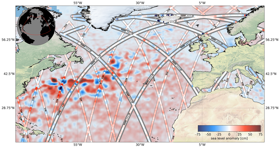
Credit: Dr Ben Loveday
Having multiple altimetry missions is also beneficial for cross-referencing the observations to make sure they are consistent, which is super important for accurate climate measurements. This is why I always joke around that altimetry is a team sport!
Besides sea surface height, what else do altimeters measure?
Beyond just observing how the sea level is changing, measuring the height of the ocean surface can provide a global picture of how ocean currents are moving. So, that is super useful. We can also tell the wind speed along the sea surface because the wind affects how rough the surface is. We can also find out the significant wave height, which is the average height of the tallest third of the waves.
This information all feeds into our understanding of physical oceanography at different time scales, whether that is right now, which is useful for people going sailing or operating a ship who would want to know how rough the sea is, all the way up to how the sea level is changing over tens of years, which is valuable for climate scientists and people working on climate change adaptation plans.
Why is Copernicus Sentinel-6 such an important mission?
It is a really important mission because people who calculate long-term sea level estimates need the consistency, accuracy, and precision the Copernicus Sentinel-6 mission brings. As a continuity mission, its sea level observations fit with those of the previous altimeters, but new aspects of its design are also opening up new applications. The way the Copernicus Sentinel-6 mission works allows us to transition from the older style of altimeter measurement to the newer style. That brings some benefits, such as being able to get data closer to the coast and exploring new methods for how we can look not just at single points where we have altimetry measurements, but also at what is going on around those points.
What does it mean that Copernicus Sentinel-6 is the reference mission for global altimetry?
This means that Copernicus Sentinel-6 is the altimeter to which all other altimeters are compared. It was made to be kind of the dream altimeter, so it makes the highest quality measurements that we can check the measurements from other altimetry missions against.
We need as much consistency as possible in sea level measurements over time. But no satellite lasts forever, so we always have to launch new ones to replace the old ones, with improvements as the technology advances. So, having one satellite or a couple of the same type of satellites that can act as a reference for other ones is super important for measuring sea level and creating a consistent, long-term record of sea level rise.
How far back do these records of sea level rise go?
Copernicus Sentinel-6 builds on the incredible heritage that we have of altimeters that have been flying since TOPEX-Poseidon was launched in 1992. That was a mission between the American space agency, NASA, and the French space agency, CNES. It was the first really big oceanographic research satellite that was producing very high quality measurements of sea level rise. Even though that one started as an experiment, over time the value of the data for physical oceanography, climate studies, and weather forecasting became clear.
That mission leads into the next series of satellites that were operated after it, which is the Jason series consisting of Jason-1, Jason-2, and Jason-3. EUMETSAT became involved in operating the Jason missions early on and in fact, still operates Jason-3, the last of these satellites. Then the European Commission's Copernicus programme joined the picture, so now we have Copernicus Sentinel-6, which is the follow-on from the Jason satellites.
Altimetry continues to be an intercontinental collaboration between the US and Europe, with NASA, the National Oceanographic and Atmospheric Administration (NOAA), the European Space Agency (ESA) and CNES, all of whom have a lot of experience in creating and running altimetry missions. We are lucky to have a big team of people who can bring together a long history of expertise to make sure this latest altimetry mission is a success.
How will EUMETSAT make sure that Copernicus Sentinel-6B, the second of the Copernicus Sentinel-6 satellites, is making measurements that are consistent with those from the first one, Copernicus Sentinel-6 Michael Freilich?
When Copernicus Sentinel-6 Michael Freilich was launched back in November 2020, it flew in tandem with its predecessor, Jason-3. We looked very closely at the measurements from both satellites as they flew together and made sure they were making the same observations about the patches of ocean they were both flying over. After doing this for some months, when we were confident that they were making similar measurements, we moved the two satellites apart in their orbits to maximise their coverage over the globe.
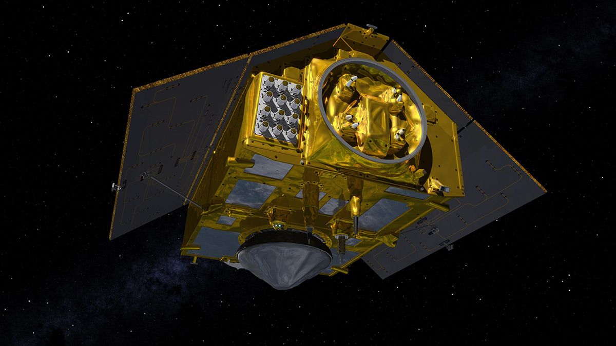
Credit: NASA/JPL
And we will do the same with Copernicus Sentinel-6B. At first, it will fly thirty seconds apart in the same orbit as Copernicus Sentinel-6 Michael Freilich to cross-calibrate the measurements from the altimeters on board each satellite. When we are satisfied that the observations from both satellites are consistent, Copernicus Sentinel-6B will stay in that orbit and Copernicus Sentinel-6 Michael Freilich will be moved to a different one.
Moving forward, why is it so important to continue to measure sea level rise?
One of the things that the altimetry time series has enabled us to see recently is that there seems to be an acceleration in the rise of sea level, which is associated with human-caused climate change. So, it is more critical than ever to continue measuring sea level rise. We want to know how quickly it is accelerating because this affects our ability to plan and adapt to the impacts.
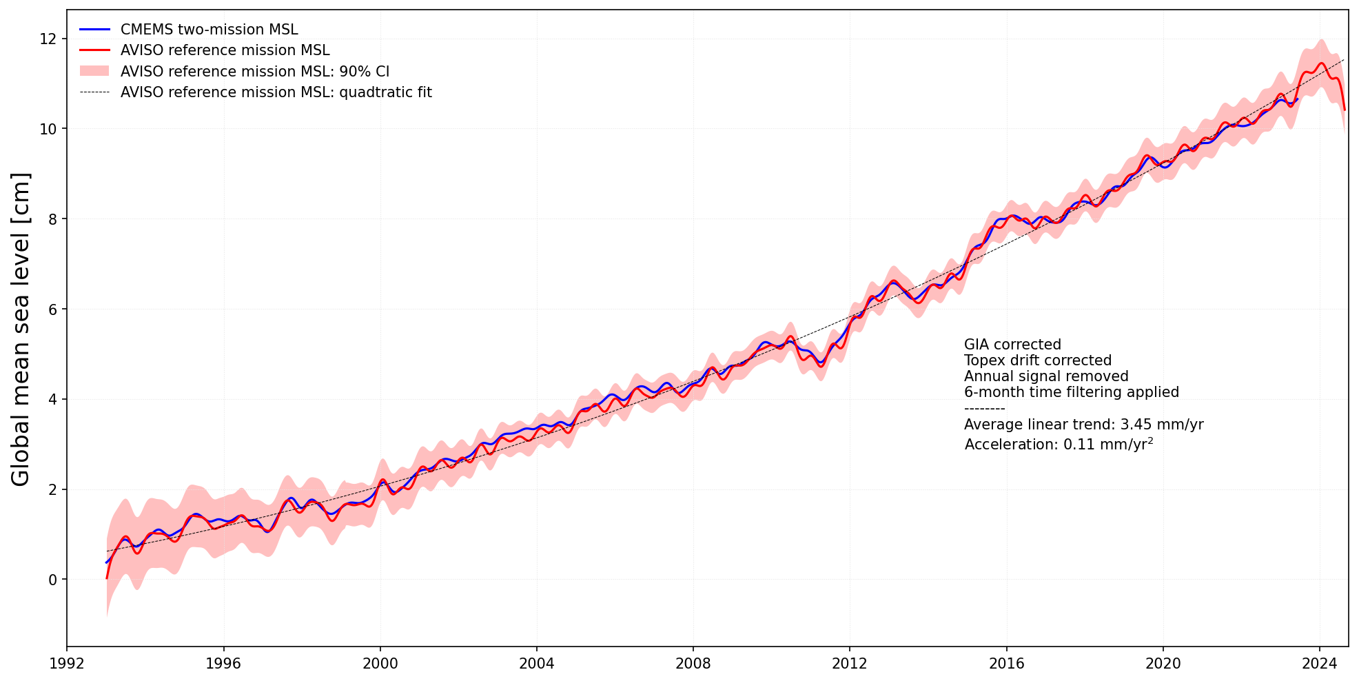
Credit: Copernicus Marine Service, AVISO/CNES
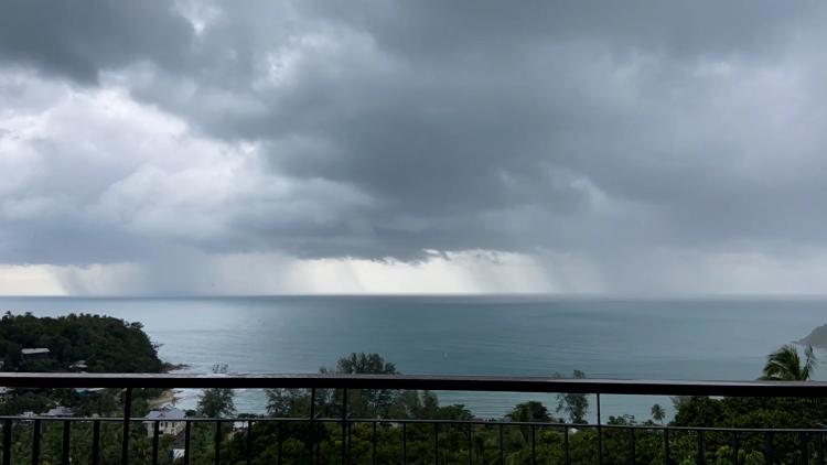
For example, sea level rise affects how high to build sea defenses and how to plan ports – the infrastructure we need to keep us safe on land from coastal floods. On top of that, storms drive sea surges, which endanger coastal communities by further exacerbating flooding.
A lot of our current defenses have been built based on the measurements of the sea level from decades ago, if not further back. To build modern defenses that will be resilient in fifty or a hundred years from now, we need to know exactly how much the sea level is going to go up, which has huge consequences for life and property in the coastal domains where people live.
Author:
Sarah Puschmann