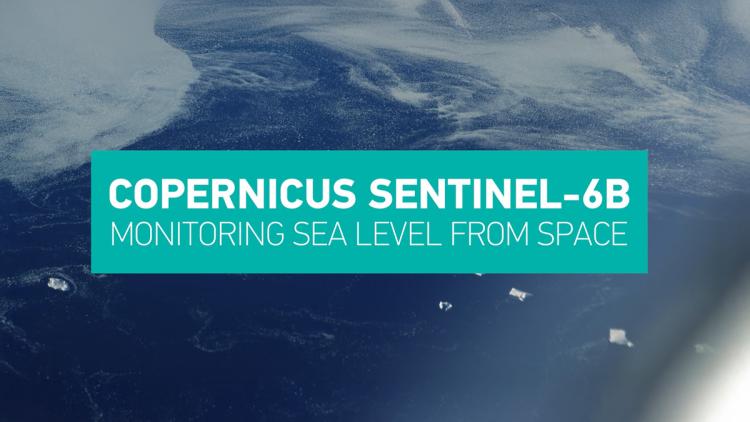
Copernicus Sentinel-6B
Copernicus Sentinel-6B will collect precise measurements of global mean sea level, significant wave height and wind over the oceans

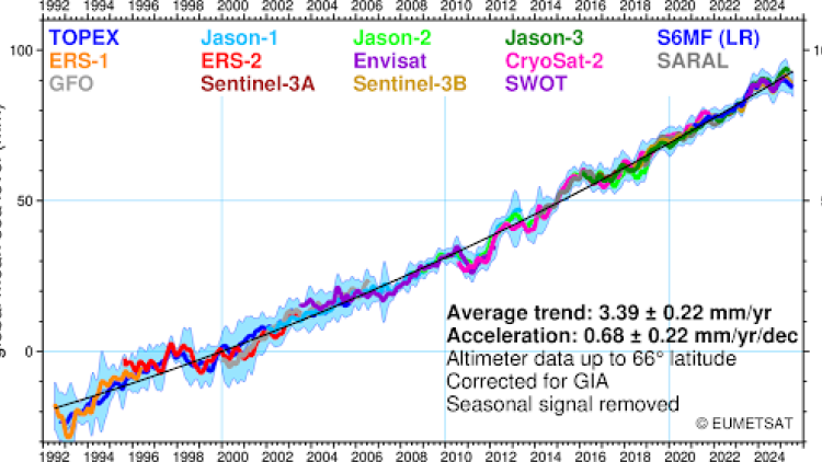
Scheduled for launch later in 2025, the Copernicus Sentinel-6B satellite will continue a time series of global sea-level measurements that began in 1992.
Last Updated
20 November 2025
Published on
17 September 2025
Copernicus Sentinel-6B will provide high-precision data on sea-surface height, significant wave height, and wind over the oceans. This information is crucial for climate monitoring and ocean and seasonal forecasts. The satellite will also collect high resolution vertical profiles of atmospheric temperature, pressure and humidity which, together with the wave and wind data, will be highly valuable input to numerical weather prediction models.
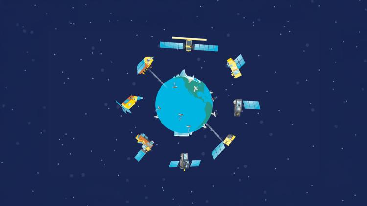
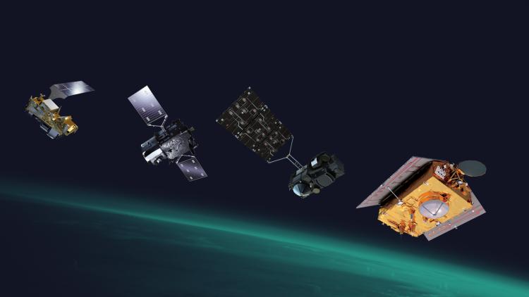
As the second of two satellites in the mission (Sentinel-6A Michael Freilich launched in 2020), Sentinel-6B will take over from the current Sentinel-6A satellite as the internationally recognized reference satellite. This means its data will be used to calibrate all other altimetry missions, ensuring the accuracy of all global sea-level measurements. The satellite's instruments include a Poseidon-4 radar altimeter, a microwave radiometer, and a GNSS-Radio Occultation instrument.
The Sentinel-6 satellites are designed to provide operational data for relevant ocean and land services at least until at least 2030. Data from the Sentinel-6 satellites are free and openly available, in line with the Copernicus data policy
Why is Sentinel-6B so important?
The Copernicus Sentinel-6 mission data is important for applications including operational oceanography and weather forecasting. Copernicus Sentinel-6 data are essential for short range forecasting of high impact weather, such as tropical cyclones, and for medium, long-range and seasonal forecasts.
Sentinel-6 data are also key inputs to the operational ocean information services delivered in Europe by the Copernicus Marine Service. Applications in the area of operational oceanography include ship routing, support for offshore and other marine industries, fisheries, and responses to environmental hazards.
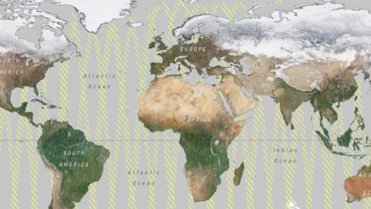
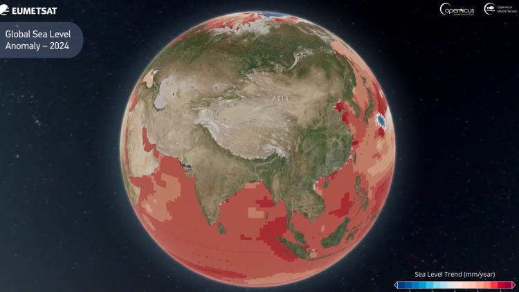
In addition, Copernicus Sentinel-6B will extend the unique record of mean sea level rise that began in 1992 with the TOPEX/Poseidon mission (1992-2006) and continued with the Jason (2001-2013), Jason-2 (2008) and Jason-3 (2016) satellites.
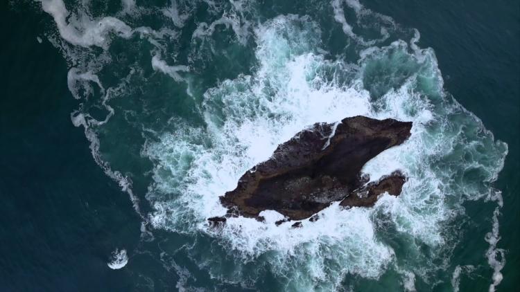
Sea level change is a key indicator of climate change, reflecting ocean warming (thermal expansion) and the addition of water from melting ice sheets and glaciers. Since 1999, global sea level has risen 9.38 cm (3.7 mm/year on average) and in the last ten years the rate has accelerated by 46%, from 2.9 mm/year (1999–2009) to 4.2 mm/year (2014–2024).
In coastal areas, research is ongoing to use Copernicus Sentinel-6 data to support the production of river discharge products that are crucial for water management and for improving the forecasts and mitigation measures related to flooding, thus protecting life and property. Copernicus Sentinel-6 data can also be used to monitor lake water levels, which is another important aspect of water management.
Who is involved?
The mission is co-funded by the European Commission, the European Space Agency, EUMETSAT and the USA, through NASA and the National Oceanic and Atmospheric Administration (NOAA). EUMETSAT operates the satellite and delivers data to users.