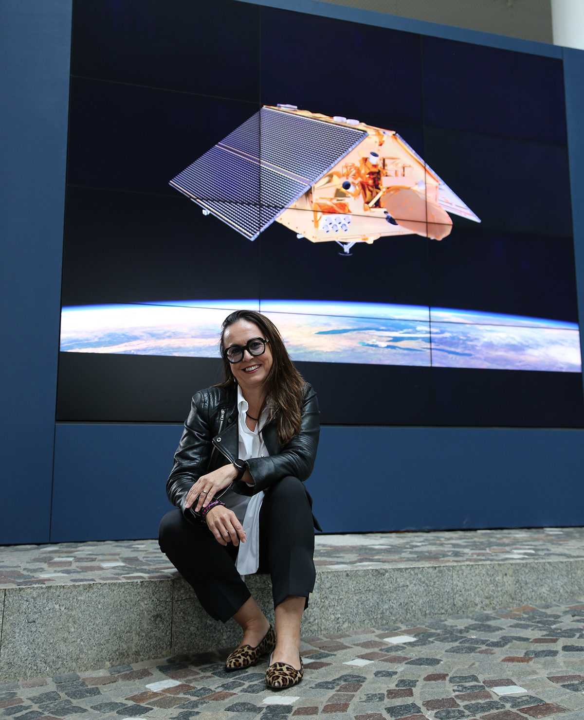
Now, as Copernicus Altimetry Missions Manager, Martin-Puig is applying the knowledge she gained during and since that Master’s degree, to helping to make the Copernicus Sentinel-6 mission a success.
The first satellite in this series, Copernicus Sentinel-6 Michael Freilich, was launched in November 2020 and the second identical satellite, Copernicus Sentinel-6B will be launched by the end of 2025. The satellites’ main payload is an altimeter, an instrument that measures sea level height by sending down radar pulses to the ocean surface. By timing the pulses’ round-trip journey, experts can determine the height of the ocean with a precision of a few centimetres
Until very recently, Martin-Puig has been responsible for coordinating the calibration and validation activities for the Copernicus Sentinel-6 mission.
“Together with my former altimetry team, we looked at the quality of the products to ensure that they satisfy the user requirements. I have been coordinating activities not only within EUMETSAT, but with all partner agencies. The cooperation and the teamwork between the different agencies involved in this mission has honestly been exemplary.”
To assess the quality of the products, which cover features beyond sea level height – including significant wave height and wind speed along the sea surface – Martin-Puig draws on a deep understanding of Sentinel-6 gained from before she even started working for EUMETSAT.
“I started working on Sentinel-6 when I worked for a startup back in 2012, long before the launch of the first satellite in 2020,” she said. “I was part of a team coding early-stage satellite data for Sentinel-6. At that time, Sentinel-6 was completely new in the sense that it included an altimeter that was so technologically advanced, learning how it worked was a challenge in itself. It had a completely new digital architecture, which no previous altimeter had before.
“It has a special mode that basically allows for both low- and high-resolution data to be acquired at the same time. Before, altimeters could either collect high-resolution or low-resolution data, but not both simultaneously. With the low-resolution data from the Sentinel-6 Michael Freilich satellite, we managed to secure continuity in the sea level climate record – we aligned these data with those collected by previous altimetry missions in this series. Then, we went one step further and achieved such good quality of the Sentinel-6 high-resolution data that they can now also be a reference.”
Martin-Puig is referring to the important role of Sentinel-6 as the global reference mission for altimetry – it is so accurate that it has been chosen as the mission against which all other altimetry missions are calibrated.
When launched, Sentinel-6B will fly only thirty seconds apart from Sentinel-6 Michael Freilich, making it possible to ensure continuity between the observations collected by the two satellites’ instruments. Eventually, the latter satellite will be repositioned and Sentinel-6B will take over the crucial role as the primary reference mission for altimetry.
After the successful launch of Sentinel-6B, Martin-Puig expects to feel proud.
“I have two kids but Sentinel-6 satellites are like my other kids. Having worked on these satellites for so long, I kind of made this constellation of satellites part of my family, as well.”
Author:
Sarah Puschmann