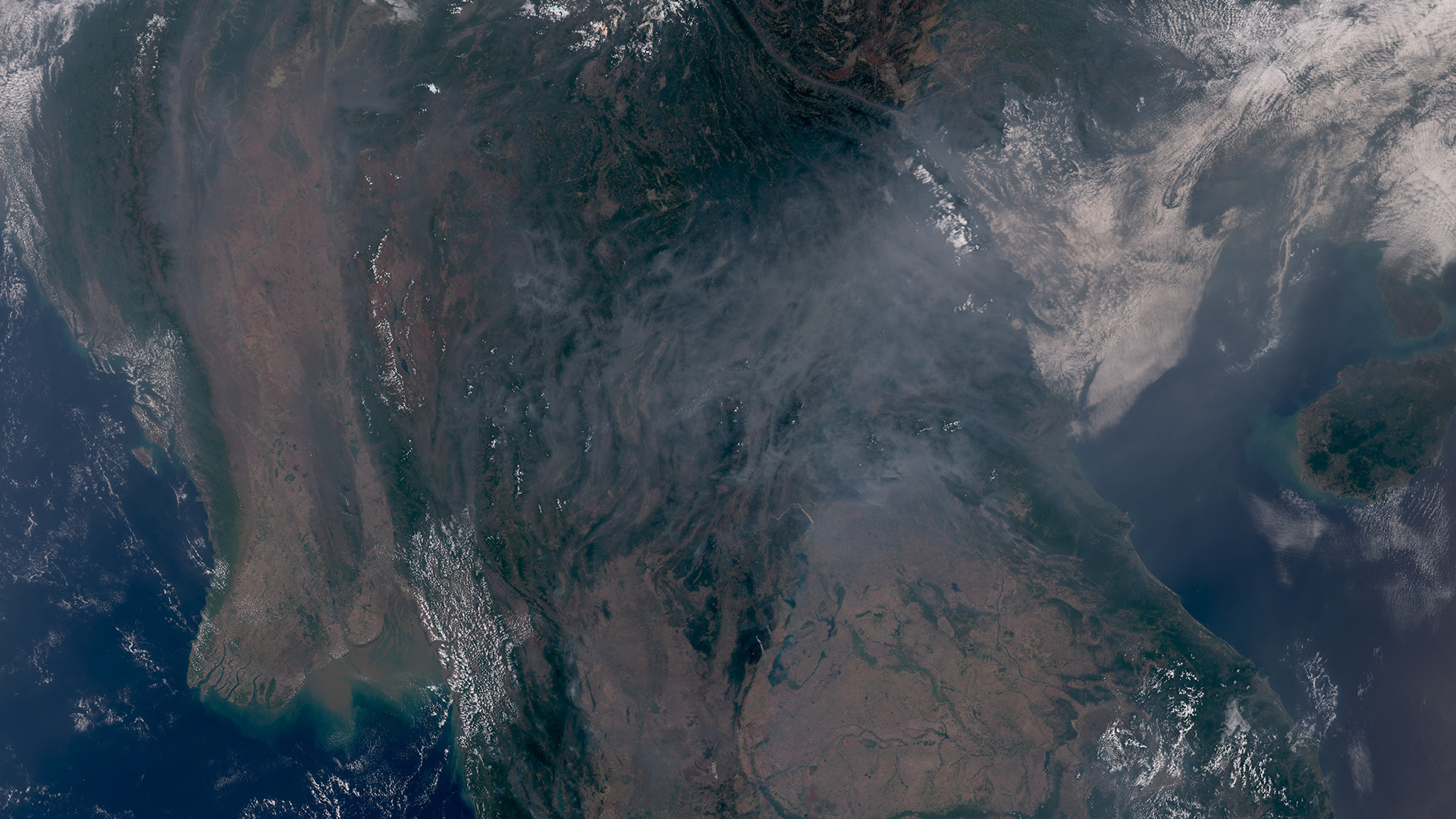
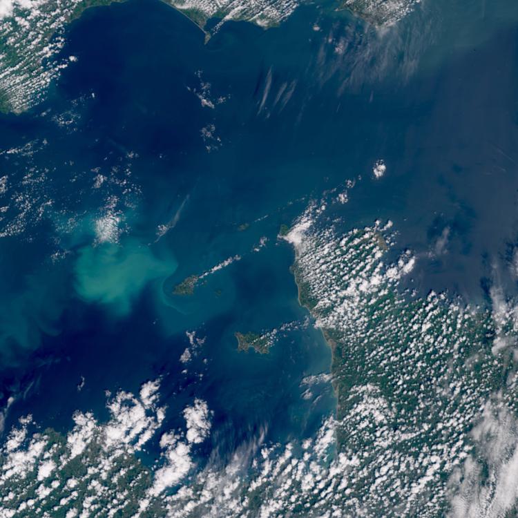
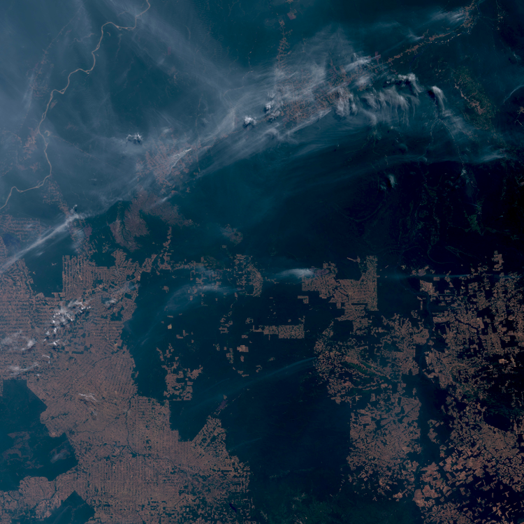
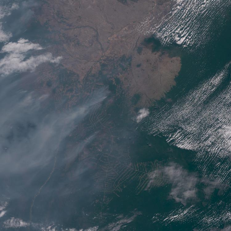
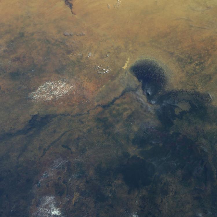
Image of the week: Haze over Southeast Asia
Watching our Earth from space

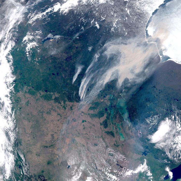
Wildfire image
The main image was captured by the OLCI instrument onboard one of the Copernicus Sentinel-3 satellites on 14 April 2026.
EUMETSAT operates the Sentinel-3 satellites, in cooperation with ESA, and delivers the marine and atmospheric data on behalf of the European Union.
More info
Follow wildfires in Southeast Asia at the Global Disaster Awareness and Coordination Centre or at the Global Wildfire Information Service
Monitor haze conditions over Southeast Asia
NASA image of the haze
How data from EUMETSAT and Copernicus satellites is used to monitor the atmosphere
How satellite data is used to help manage wildfires
View our new guide to using Earth observation to detect, monitor and assess wildfires
Access atmospheric data from EUMETSAT User Portal