28 March 2023
04 March 2019
Precise geolocation of satellite imagery is fundamental for systematic climate observations. It allows multi-sensor composites and long-term time series of Essential Climate Variables (ECVs). The World Meteorological Organization (WMO) summarizes baseline requirements for satellite-based climate products in (GCOS 2006). It requires for moderate-resolution optical instruments a geolocation accuracy better than 1/3 of the instantaneous field of view (IFOV) in the terrestrial domain.
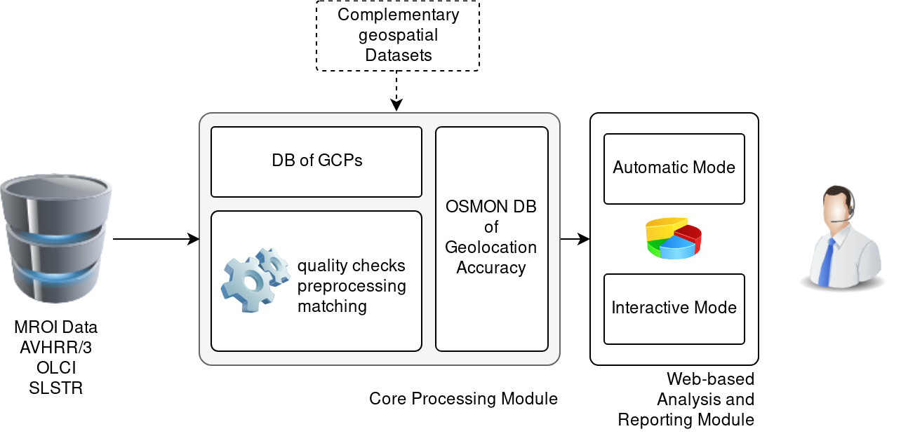
The tool supports Level-1 products from the current medium resolution (MROI) EUMETSAT sensors AVHRR/3, SLSTR and OLCI and is extendable to near-future sensors. For the shift estimation, an iterative area-based cross-correlation method was selected to match Landsat-8 NIR and TIR bands against MROI-DataWindows (MROI-DW). The Geolocation Assessment Tool has a modular design. It consists of a Core Module and a Reporting Module.
Objectives
The main project objectives are
- Generating and delivering a stand-alone environment for assessing the geolocation accuracy of moderate to high resolution optical satellite sensors.
- Developing, testing and documenting an automatic monitoring and reporting system for detecting and quantifying possible geolocation errors.
- Providing tools for continuously monitoring geolocation performance of image data as they are acquired and circulated to users.
- Enabling quick and reliable validation of new datasets in case of a change in the processing baseline for optical sensor products that might affect the geolocation accuracy.
- Evaluating the spectral and temporal registration accuracy and stability of EUMETSAT optical sensor payloads by analysing long time series.
Overview
The Geolocation Assessment Tool has a modular design. It consists of a Core Module and a Reporting Module.
The core module performs the calculation of the geolocation shifts between MROI and high-resolution reference data using features which are clearly identifiable in MROI datasets (such as lakes, islands).
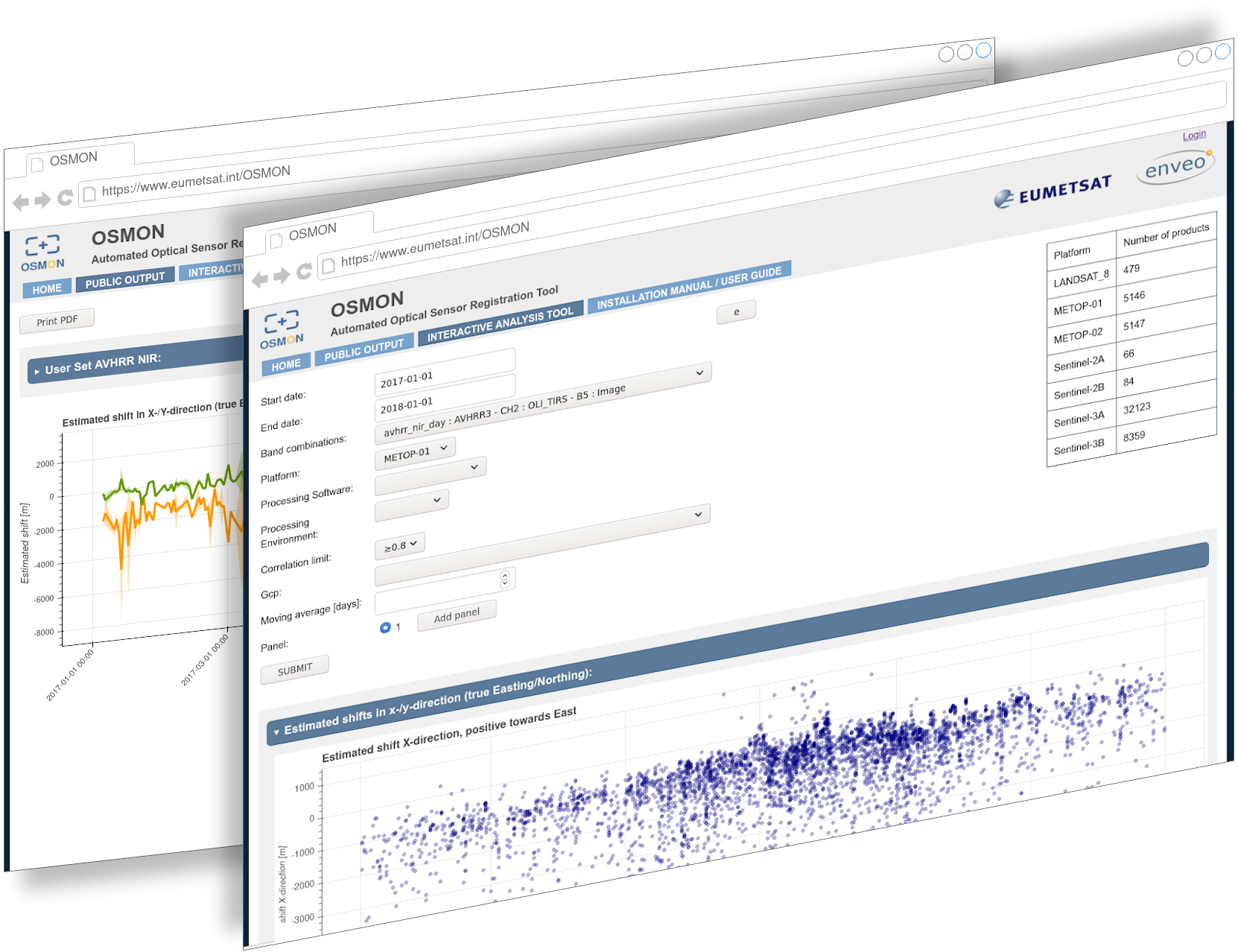
The reporting module takes care of visualisation (Figure1), evaluation and analyses of geolocation shifts and generation of reports.
Figure 2 shows the concept of the processing line. Input to the procedure are Level1B (swath geometry) or Level-2 (geocoded) MROI data from Metop AVHRR/3, and Sentinel-3A/B SLSTR and OLCI. The module design allows to add other and upcoming MROI sensors like MetImage.