Europe’s first meteorological satellite in polar orbit ends its run
Goodbye, Metop-A

Metop-A has been providing meteorological data to global users for fifteen years, three times longer than expected.
01 April 2022
15 November 2021
The process of taking Metop-A, Europe’s first polar-orbiting meteorological satellite, out of service has begun today.
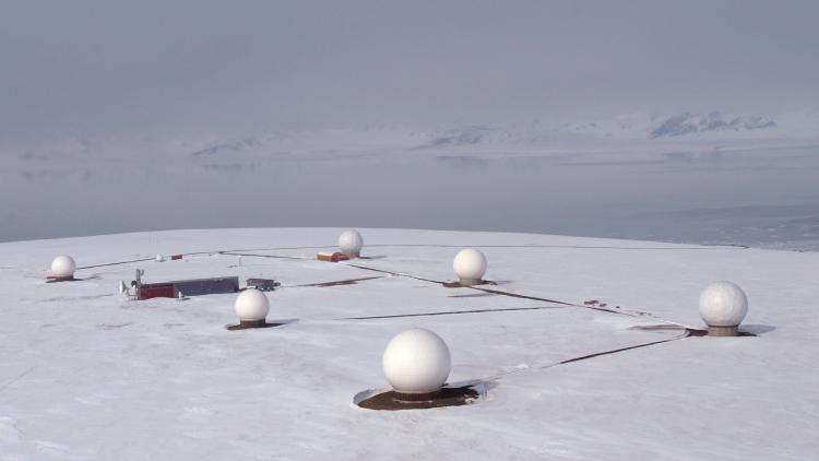
Launched on 19 October 2006, Metop-A flies in a sun-synchronous orbit, a type of polar orbit in which the satellite passes over each point along its route at the same local time every day. Metop-A works in conjunction with Metop-B and Metop-C to form the EUMETSAT Polar System. Together, these three satellites provide global users with crucial weather data that significantly reduce forecasting errors as well as climate data that is used for monitoring climate change.
Metop-A carries twelve instruments that collect radiation reflecting off the Earth, which remote sensing experts analyse in order to infer information about various features of the atmosphere including temperature, humidity, and gases, as well as the speed and direction of ocean winds, among others.
“Metop A has provided scientific information of the highest quality since it was launched and, since then, its contribution to weather forecasting and climate monitoring has been priceless,” said Stefania Tarquini, Low Earth Orbit Spacecraft Operations engineer and the End-of-Life Project Manager for Metop-A.
Metop-A is notable for being the first satellite subject to an agreement between the United States and Europe that involved US instruments, provided by the United States National Oceanic and Atmospheric Administration (NOAA), being flown on a European satellite, operated by EUMETSAT.
"Metop-A is the cornerstone of space cooperation between NOAA and EUMETSAT that spans more than 20 years," said Dr Steve Volz, assistant administrator for NOAA's Satellite and Information Service. "The strength of this partnership will continue to be pivotal in meeting future challenges of monitoring our global climate and oceans from the polar orbit."
The process of removing the satellite from its orbit, known as deorbiting, begins with a series of manoeuvres that will be conducted over the next ten days. The satellite will be lowered so that its point of orbit closest to the Earth is decreased from 817km to about 530km.
Then, as the satellite travels northward from the South Pole, it will perform a backflip manoeuvre over the course of the fifty minutes it takes to travel up to Svalbard, Norway. This manoeuvre, a first for EUMETSAT, will allow the instruments, which normally scan the Earth, to instead scan deep space.
“This is a very special test because the spacecraft was never designed to do such a thing,” said Tarquini. “It is something completely innovative for EUMETSAT.”
In an ideal world, satellite instruments would detect signals with perfect accuracy. But the reality is different. In the real world, satellite instruments are subject to time and microvibrations, among other hazards, causing minor distortions to their signals. When a satellite instrument scans the Earth’s atmosphere in order to determine the humidity over Berlin, Germany on a November morning, for example, it is difficult for remote sensing experts to distinguish the actual signal from the slight bias that marginally alters this signal because their only source of information about that exact slice of atmosphere at that particular time is that one instrument.
This is why the backflip manoeuvre Metop-A will perform is so important. Because space has a uniform temperature of 2.73 Kelvin (a frigid -270.42 Celsius), remote sensing experts know exactly what signal to expect when the satellite instruments scan it. By noting how the expected signal differs from the detected one, EUMETSAT teams will be able to identify the unknown biases that inevitably crept into the instruments’ measurements as the satellite aged.
The data acquired during this manoeuvre will lead to an improved calibration of the monitored environment, providing a new baseline for data processing that can be applied retrospectively to all Metop data already received. In addition, this new baseline can be applied to new data from the entire lifetimes of the two remaining satellites in the EUMETSAT Polar System, Metop-B and Metop-C, which will increase the accuracy and consistency of the long-term climate data records.
This manoeuvre will be especially useful for two instruments, the Advanced Microwave Sounding Unit-A, which measures atmospheric temperature, and the Microwave Humidity Sounder, which collects information about atmospheric water vapour.
After Metop-A transmits the information it gathers from the backflip manoeuvre to the Svalbard ground station, any fuel that remains will be used up through an additional series of manoeuvres before the batteries and transponders are disconnected. Then, the satellite will be left to spiral downward in progressively lower orbits until it disintegrates upon re-entering the Earth’s atmosphere. This process is expected to end within the next twenty-five years, in accordance with international standards on space debris mitigation. Although the satellite was launched before these standards were instituted, and so is not subject to them, EUMETSAT has opted to abide by these standards in order to fulfil its commitment to keeping space clean.
When Metop-A was launched, it was loaded with significantly more fuel than ended up being necessary to power the satellite for its expected lifetime of five years. Because of this, the satellite was able to continue to collect and transmit crucial weather data for fifteen years, three times longer than initially anticipated.
The two remaining satellites in the EUMETSAT Polar System, Metop-B and Metop-C are expected to operate until 2027 and into the 2030s, respectively, ensuring that the essential data these satellites transmit about the Earth’s environment will continue, uninterrupted, for many years to come.
Author
Sarah Puschmann