GAIA-CLIM
Gap Analysis for Integrated Atmospheric ECV Climate Monitoring.


Marie Doutriaux Boucher, Climate Services Product Analyst at EUMETSAT together with Arndt Meier, GAIA-CLIM Engineer at EUMETSAT, explain the GAIA-CLIM project in this interview.
11 March 2021
30 November 2016

What is the GAIA CLIM Project?
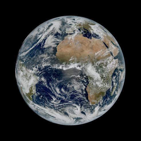
GAIA-CLIM is a European Union funded project composed by 18 partners, including EUMETSAT. GAIA-CLIM aims at bringing together and comparing observations of the same climate phenomenon gathered by different instruments in a consistent manner. To date huge amounts of Earth observation data exists.
In principle, all the different observation methods from ground, space, and in-situ complement each other. However, in spite of the volume of observations, there are a number of gaps and shortcomings in the existing observations that prevent us from using this data to its full potential. In particular, the use of this data as a climate data record is compromised.
The climate change signals we are interested in, need to be detected over time scales of decades or more.
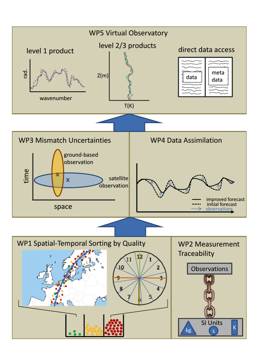
These climate signals are often much smaller than daily, weekly or monthly variations or the differences between different observation methods. This is why it is fundamental that all instruments and all data processing methods are fully characterised, with common descriptors for uncertainties for all observation methods. The latter we have not achieved yet, although individual methods are characterised to various degrees of completeness. Several project partners within GAIA-CLIM have created a common document that identifies the gaps and shortcomings in current and recent earth observations, the so-called GAIA-CLIM Gaps Assessment and Impacts document.
It is deemed that only if all earth observations fully describe their uncertainties, and more so in a way that allows tracing these back to fundamental/international measurement standards and that use a common formalism to describe these, can we really combine the different observations in a meaningful way to form a significantly improved description of the earth system.
Once a concise characterisation of uncertainties has been implemented, the project progresses to take ground-based observations, in-situ observations like radiosondes (weather balloons) and others, and compare them with satellite observations for a number of different atmospheric Essential Climate Variables (ECV)s.
The purpose is to organise access to data and results all the while indentifying uncertainties. In order to achieve this, the project will include in the process also feedback from numerical weather prediction (NWP), reanalysis models and eventually climate model outputs.
The main outcome will be a “Virtual Observatory”, a website with an elaborate validation tool. “Under the hood” are advanced algorithms that grab co-located observations, those are observation pairs where any 2 instruments sample the same airmass, from all participating partners according to the user's choices of which products from which instruments to compare, over what time periods and how close the match has to be in time in space. The tool will then create written reports, statistical analysis and visualisations of how well any two sets of observations agree within their combined uncertainties. This versatile tool shall then also be used to inform other activities.
Why is it so important to have an estimate of uncertainty with data used for climate studies?
An observation is not an absolute truth. Uncertainties are needed to compare models with observations. Are two observations telling the same story within their given uncertainties? How much confidence can we have in the results?
Do I get a higher confidence, if I combine multiple observations, and if yes how much higher? Uncertainties are also needed in data assimilation (where error covariance matrices for the background and for observations are keys).
By combining and comparing different observations, we can reduce uncertainties and reach an improved product. In turn, with this improved product we can expect to reach more detailed climate data records in the long run. Predictions related to climate data records are impossible or totally untrustworthy without a consistent treatment of all uncertainties.
What is the extent of EUMETSAT's participation?
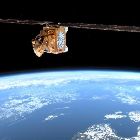
EUMETSAT is leading the creation of the virtual observatory, as described above, that will comprehend a combination of international satellite observations, including from EUMETSAT, with ground-based and in-situ reference observations produced by amongst others the Global Reference Upper Air Network (GRUAN), the aerosol measurement network AERONET and the Network for Detection of Atmospheric Composition Change (NDACC).
The targeted observable quantities are the key descriptors of the state of the atmosphere and key climate variables such as atmospheric temperature profiles, humidity profiles, aerosols and atmospheric constituents’ profiles like ozone, carbon dioxide, methane and nitrous oxide.
What are the tools and/or datasets you will produce and how will they improve existing ones?
The access policies for all the different observations are a jungle, scattered over numerous access portals, each with a different user interface and typically non-existent, incomplete or at least non-transparent uncertainty descriptors and any two products cannot generally be compared directly.
GAIA-CLIM will provide a unified platform for co-located observations, with built-in statistics and error propagation tools for both level 1 and level 2 products making it a unique and powerful tool for users. To our knowledge no other web tool exists that combines the observation uncertainties seamlessly. For the development of the Virtual Observatory, we have identified the following key Essential Climate Variables (ECVs):
- Temperature profiles
- Humidity
- Aerosols
- GCOS Greenhouse gases, initially ozone possibly followed by nitrous oxide, methane, carbon dioxide and others...
- All ECVs will be augmented with information from Numerical Weather Prediction model/reanalysis systems.
Forward radiative transfer will be implemented where feasible. This allows comparing original quantities to be compared rather than derived products.
The project will end in February 2018 after the release of the Virtual Observatory.
How will you support Copernicus?
The framework that will have been created will be of high and direct benefit to Copernicus as similar needs have been identified. The project is committed to provide at least a demonstrational Virtual Observatory. However, the design is such that it will be suitable for later integration into operational use.
In this case, additional funding will have to be sought to transform the Virtual Observatory into a reliable tool for near-real-time integration in the operational work flow. At that stage it should become a sustainable facility that supports Copernicus Services and science to analyse product quality in routine mode.