
How satellites can help detect impending droughts
In this era of seeming plenty, it’s shocking to learn that almost 124 million people faced crisis levels of food insecurity last year.


According to the UN Global Report on Food Crises 2018, climate-related shocks were the main drivers of food insecurity in 23 countries in 2017, affecting more than 39 million people.
19 May 2022
12 June 2018
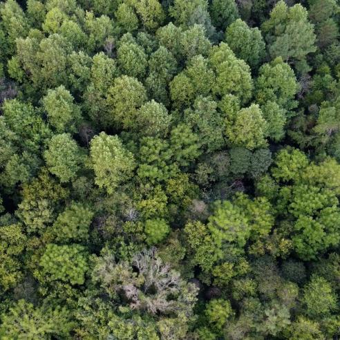
Drought was the most common of those climate-related contributors. Satellite observations can be used for weather forecasting, measuring the water levels in lakes and rivers and giving information about vegetation cover, as just a few examples.
Meteorological and environment-monitoring satellites provide a range of data that can be used to help detect the signs of drought. Observations can be used for weather forecasting, measuring the water levels in lakes and rivers and giving information about vegetation cover, as just a few examples.
The need for space-based observations
Professor Wolfgang Wagner, from the Vienna University of Technology, who carries out research and development in the framework of EUMETSAT’s Support to Operational Hydrology and Water Management Satellite Application Facility (H SAF) pointed out that soil moisture levels can be a very good indicator of drought.
H SAF
The H SAF develops, validates and operationally generates, validates, distributes and archives high-quality products for operational hydrological applications. The products provide information related to precipitation, snow and soil moisture.
The impact and benefit of these products are continuously assessed through independent validation, which is an essential part of the H SAF as well. The main observations used to derive the products are gathered from satellite instruments measuring microwave and infrared radiation.
These sensors fly on Earth observation satellites in geostationary and polar orbits, operated by EUMETSAT and other satellite organisations. H SAF products are available for users free of charge. Please visit h-saf.eumetsat.int for more information and access to the data.
“Together with precipitation measurements, remotely-sensed vegetation indices are often used as drought indicators, but when soil moisture is low, it’s a step before there is a drought impact on the vegetation,” Professor Wagner said.
“Low soil moisture levels can hence be an early warning of drought, particularly in areas where there are very few precipitation gauges, such as in poor, rural areas in Africa. Ground observation coverage in those areas is typically poor.”
Prof Wagner said in-situ measurements, such as from rain gauges, are still the most common source of information about drought in such areas. However, insufficient precipitation measurements can create misleading impressions. “During a recent drought in Kenya, lots of precipitation data sets looked as though there was good rainfall,” he said. “However, in reality, there was a lack of rain over a large part of the countryside; rainfall had been wrongly interpolated from few rainfall stations.”
Providing soil moisture data from space
The Advanced Scatterometer (ASCAT) on board EUMETSAT’s polar-orbiting Metop satellites measures, among other things, the amount of moisture in soil. “ASCAT data very clearly picked up that several consecutive rainfall seasons had totally failed in the northern part of Kenya,” Prof Wagner said. “Three to four failed seasons means you have big troubles on the ground.” The microwaves emitted by the instrument can penetrate a few centimetres into the soil. Water molecules react very directly to microwave radiation, absorbing and scattering the waves. The more water in the soil, the stronger the ASCAT signal. Hence it becomes possible to measure soil moisture with ASCAT. Over Africa, the ASCAT soil moisture data are, in general, very reliable except in tropical forest regions where the ASCAT signal cannot penetrate thought the dense forest canopy and some arid regions where the signal may penetrate deep into the extremely dry soils.
Using the data
Prof Wagner said the number of operational users of these data is increasing but most – about three-quarters – are still involved in research and development. The ASCAT soil moisture products generated by the H SAF can be used directly or in the form of value-added products generated by the Copernicus Global Land Service and the European Centre for Medium-Range Weather Forecasts. An important aspect of the data provided by the Metop ASCAT instrument is its temporal coverage. Every point on Earth is covered every day.
Soil moisture anomalies in the Western Cape province
The impact of drought in South Africa’s Western Cape province received international attention this year when the unthinkable almost became a reality. Cape Town, the second-largest city in the country, with a population of more than 3.5 million, faced “Day Zero”, when extended drought was expected to cut off water supplies entirely. Thankfully, this has now been averted. However, the drought led to unprecedented water restrictions in the province, including a daily limit of 50l per person and severe curtailment of water use for agriculture and industry. Prof Wagner’s team at the Vienna University of Technology produced this graphic depicting soil moisture anomalies, averaged for the whole province of Western Cape, calculated from Metop ASCAT data.

The anomalies are calculated as the difference from the long-term seasonality for the period 2007-2017. Wetter years in 2012 to 2014 are clearly visible and are followed by the negative anomalies since 2015. The average soil moisture over the whole period was 10.6 percent. The anomaly for 2017 is visibly very severe.
The SAF network
EUMETSAT has a network of eight specialised Satellite Application Facilities (SAFs) which are part of the organisation’s distributed ground segment, each one focussing on tailored products for specific user communities or application areas. The SAFs are responsible for research, development and operational activities for products and services (data and software) complementing the portfolio of the central facility at EUMETSAT headquarters. The SAFs are located within EUMETSAT’s Member States and formed by consortia of National Meteorological Services or other entities. You can find out more here. The EUMETSAT Support to Operational Hydrology and Water Management SAF (H SAF) has the Italian National Meteorological Service COMET (Italian Airforce) as its Lead Entity. H SAF applications are foreseen to fit with the objectives of other European and international programmes with special relevance to those initiatives which aim to mitigate hazards and natural disasters, such as flash floods, forest fires, landslides and drought conditions, and improve water management.
