Brewing up a storm in 2017
The brute strength of nature was particularly evident in 2017 when hurricanes, typhoons and cyclones left trails of misery in their wake in communities around the globe.

We’ve just published our annual “Year of Weather” video for 2019 and once again, many significant weather events took place across the globe.

17 May 2022
28 April 2020
The planet was hit by a number of hurricane's, heatwaves and wildfires. However, thanks to the observations of satellites operated at EUMETSAT and by our international partners, weather services have access to a large amount of data that they can communicate to the public and can, for example, issue warnings in the event of a severe storm to lessen the amount of lives lost or damage caused to property.
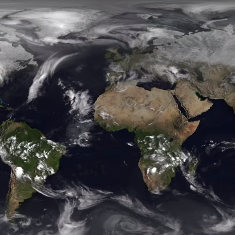
The annual year of weather series is made with the help of our partners and comprised of imagery from the geostationary satellites of EUMETSAT, NOAA, the CMA and JMA, combined with data from EUMETSAT's polar orbiting Metop satellites.
This ultra-high resolution (4K) visualisation has been produced by EUMETSAT's data visualisation team and is composed of a satellite infrared data layer, provided by Météo-France, superimposed over NASA's 'Blue Marble Next Generation' ground maps, which change with the seasons.
For previous year of weather videos and our monthly series, head over to our YouTube channel.