Metop SGA1 / Credit: ESA

IASI-NG instrument on Metop-SGA1 satellite sends back first data


It will sound the atmosphere with unprecedented precision

Metop SGA1 / Credit: ESA
EUMETSAT

The IASI-NG instrument (Infrared Atmospheric Sounding Interferometer-New Generation) flying on the Metop-SGA1 weather satellite has sent back its first data.

Last Updated

22 October 2025

Published on

22 October 2025

Lifted into space from the Guiana Space Centre by an Ariane 6 launcher on Tuesday 12 August 2025, the IASI-NG instrument (Infrared Atmospheric Sounding Interferometer-New Generation) flying on the Metop-SGA1 weather satellite has sent back its first data. The calibration/validation phase is now underway to precisely calibrate the instrument and refine processing parameters to obtain perfectly calibrated atmospheric spectra for operational distribution to users in 2026. These data are eagerly awaited by the international scientific community and national weather services.

Metop-SGA1 was developed by the European Space Agency (ESA) on EUMETSAT’s behalf and is operated by EUMETSAT. At the end of the in-orbit commissioning phase, EUMETSAT will take over management of operational data for all instruments on the satellite. CNES has overall technical responsibility for IASI-NG, including during in-orbit commissioning, with support from the French national scientific research centre CNRS and national weather service Meteo-France. CNES also developed part of the EUMETSAT processing chain that turns raw acquisitions from the instrument into atmospheric characterization data, and is in charge of developing and operating a technical expertise centre to monitor the instrument’s performance in orbit. The instrument was built for CNES by Airbus Defence & Space, working from instrument specifications and science goals established by the scientific community.

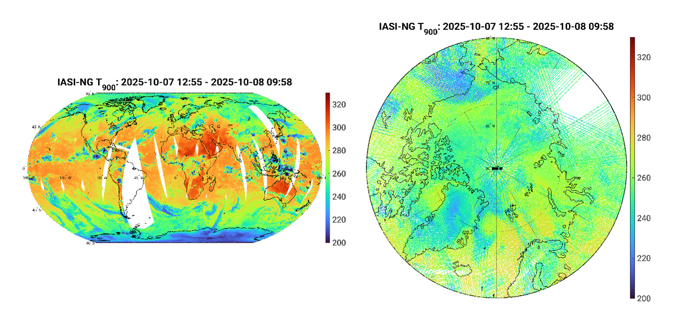
IASI-NG is designed to observe Earth’s atmosphere for meteorology, climate science and air quality monitoring. It succeeds the IASI instruments operating on the first generation of Metop satellites since 2006. It is set to improve performance by a factor of two and will sound the atmosphere with unprecedented precision, measuring temperature, humidity and atmospheric composition (ozone, methane, carbon dioxide, aerosols, etc.) continuously over a period of 20 years, thus making a significant contribution to the monitoring of Earth’s climate. CNRS research laboratories are closely involved in processing IASI-NG spectra to extract the geophysical and climate data required to characterize and monitor the planet’s atmosphere.

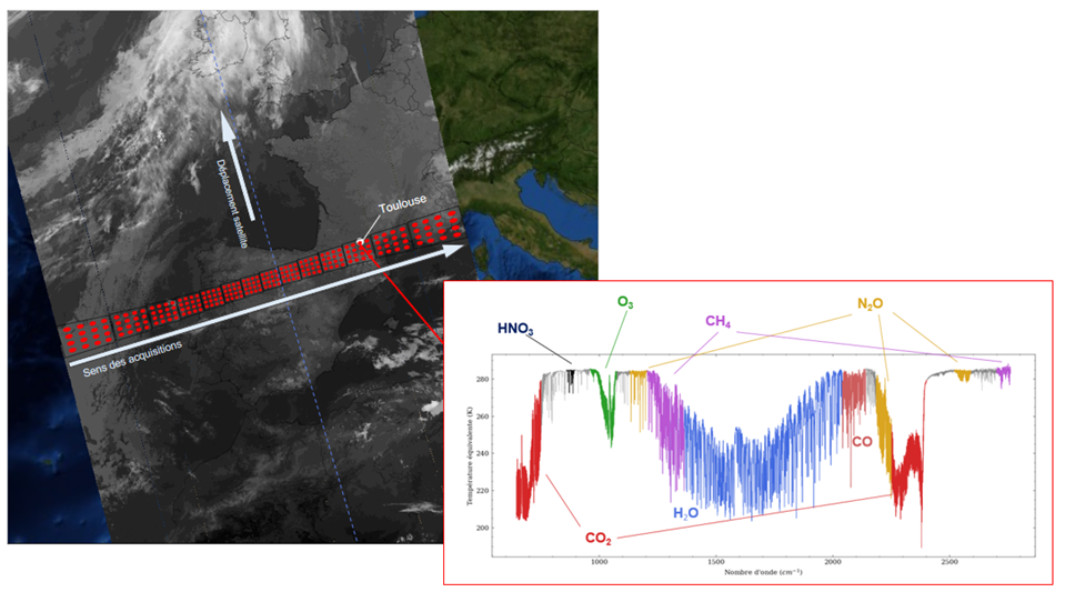
The first data from the IASI-NG instrument were generated from raw measurements processed with system settings defined during ground testing. This first spectrum shows the composition of the atmosphere seen by the instrument as the satellite was flying over Toulouse, France.

IASI-NG splits light waves reflected from Earth according to their frequency. Snapshots of the atmosphere are obtained from 16,921 separate data points (spectral channels), each of which can be selected and compared to any other point on the globe. This atmospheric spectrum represents the amount of energy measured as a function of light wave frequency in IASI-NG’s infrared range. Providing much greater detail than its predecessor, the instrument is able to identify the characteristic signatures of molecules in the atmosphere. These initial spectra acquired on 30 September already give a glimpse of the broad variety of chemical species that IASI-NG can sense, such as carbon dioxide, nitric acid, methane or ozone.

Premier spectre de l’atmosphère acquis par l’instrument IASI-NG au-dessus de Toulouse.png
First atmospheric spectrum acquired by the IASI-NG instrument over Toulouse, France. 
©CNES, 2025
En compilant les données d'un seul canal spectral sur plusieurs orbites.png
By compiling data from a single spectral channel over several orbits, we can generate a synoptic picture of this specific atmospheric characteristic. This is a composite image of 7 October 2025 from the 11-μm channel, highlighting the thermal properties of clouds and Earth’s surface.

The instrument observes radiation from Earth, and the spectral lines it sees show light absorbed by the different molecules in the atmosphere at that particular time. The depth of these lines tells us how many molecules are present, while the sharper resolution allows us to determine this information with greater accuracy at different altitudes.

This range of molecules, along with humidity, temperature, dust and cloud profiles, will be targeted by the mission and measured more than a million times a day, across the surface of the globe and the entire depth of the atmospheric column, for the next two decades.

The first data also include information acquired by IASI-NG’s imager, which operates in an infrared channel and enables exact co-registration of sounding points with images. All data are acquired by scanning left to right along the satellite’s track.

The IASI-NG instrument’s improved performance is made possible by an innovative Mertz interferometer[1] concept, deployed for the first time on a space mission. Its measurements will enable extraction of more accurate vertical profiles of temperature and humidity close to the surface, a key requirement for further improving global and regional numerical prediction models.

The IASI-NG mission is a key element of international climate science efforts. Its improved performance will deliver more data on greenhouse gases and deeper insights into the chemical components in the atmosphere to better estimate air quality.

The IASI-NG mission is expected to continue acquiring data until at least 2047 and possibly beyond. Added to the dataset built up by the previous generation of IASI instruments, these data will provide an unprecedented climate record covering more than 40 years of global atmospheric observations.

[1] The Mertz principle is based on a Michelson interferometer that compensates for field effects by inserting in the optical path a plate whose thickness is controlled to provide the right optical index. 


About EUMETSAT

EUMETSAT, Europe’s meteorological satellite agency, monitors the weather and climate from space. Based in Darmstadt, Germany, EUMETSAT provides its 30 member states with meteorological imagery and data that are essential for keeping their communities safe and for the benefit of critical sectors of their economies.

EUMETSAT’s 30 member states are: Austria, Belgium, Bulgaria, Croatia, Czech Republic, Denmark, Estonia, Finland, France, Germany, Greece, Hungary, Iceland, Ireland, Italy, Latvia, Lithuania, Luxembourg, the Netherlands, Norway, Poland, Portugal, Romania, Slovakia, Slovenia, Spain, Sweden, Switzerland, Türkiye and the United Kingdom.


Press release translations