Arctic sea ice reaches sixth-lowest minimum
Dr Rasmus Tonboe explains what that means.

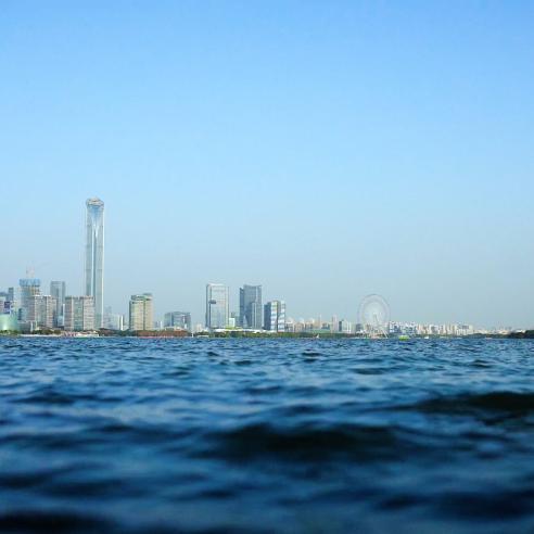
In the same week that representatives from 195 countries are meeting in South Korea to discuss a special report on global warming (see below), new information has been released about one of the key indicators of climate change – the extent of sea ice in the Arctic.
09 August 2021
05 October 2018
For 40 years, satellites have been used to gauge the extent of sea ice in the Arctic, with particular emphasis on the minimum reached after the “melt season” and maximum after the “growth season”.
This year’s minimum extent was reached on 19 and 23 September, somewhat later than usual, and was the sixth lowest on record. However, the 2018 minimum was significantly higher than the lowest on record – reached in 2012. So, is that cause for optimism? No, not really. Dr Rasmus Tonboe, Sea Ice Researcher with the EUMETSAT Ocean and Sea Ice Satellite Application Facility (OSI SAF), explains.

2018 Arctic sea ice minimum in context
- The Arctic sea ice extent reached a minimum of 4.59 million km² on 19 and 23 September
- The same minimum was reached in 2008 and 2010 - 23 September is one of the latest dates to reach the annual minimum, tying with 1997
- The lowest minimum Arctic sea ice extent recorded since satellite records began 40 years ago was 3.39 million km², reached on 17 September 2012
- The 12 lowest minimum extents recorded over the past 40 years have occurred over the past 12 years
Three important factors shaping the annual minimum
Three factors play a critical role in determining the minimum sea ice extent in the Arctic each year, Dr Tonboe said.
- How robust the ice is at the beginning of the melt season
- When the melt season starts
- The weather during the melt season
“DMI (the Danish Meteorological Institute) showed that the sea ice was a little bit thicker going into the melt season this year than last year,” Dr Tonboe said. “That was a good indication there would be a little bit more ice than last year.
“The melt season starts when the snow on top of sea gets warm. It changes its radiative properties and absorbs more solar radiation. Solar radiation reaches its maximum in the Arctic just before mid-summer because of the angle of the Sun and because there are usually less clouds in mid-summer.
“This year’s melt season started very close to normal in June, so it was not really a good indication of how much ice is left at the end of the season.
"The weather was divided into two parts during the melt season. In the eastern Arctic, north of Siberia, it was warmer than usual. In the western Arctic, north of Canada, it was colder than usual.
“This directly affected the North-West and North-East Passages. The North-East Passage was open because it was warmer and the North-West Passage and many of the straights were closed.”
Not unusual, but significant nonetheless
Dr Tonboe said that, apart from occurring a little later than usual, this year’s sea ice minimum was not very unusual.
“The last 12 years are also the 12 years with the lowest sea ice extent,” he said. “There is a lot less sea ice than there used to be. That’s part of the ongoing trend caused by global warming.
“The decline of the sea ice extent in the Arctic is one of the most important indicators of global warming while it’s actually going on.
“The sea ice extent is cut in half and the thickness is cut in half – it is a quarter of what it used to be.
“This is quite dramatic. It clearly shows that global warming is happening and is going on right now.”
How is the sea ice extent measured?
The EUMETSAT OSI SAF uses data from Special Sensor Microwave Imager Sounder (SSMIS) passive microwave radiometers on US satellites and Advanced Microwave Scanning Radiometer 2 (AMSR-2) data processed by the Japan Aerospace Exploration Agency (JAXA) to determine Arctic Sea Ice concentration.

“We measure the signal of the ice and water then we can invert to get a sea ice extent, how much open water is covered by sea ice,” Dr Tonboe said.
The SAF is currently preparing to ingest data from the EUMETSAT Polar System-Second Generation (EPS-SG) satellites, which are planned for deployment from 2022.
What will 2018’s minimum be remembered for?
“This season will mostly be remembered for two things,” Dr Tonboe said.
“During late February, when it was really cold and dark, very warm and strong wind was blowing from Greenland, which opened a large crack in the ice.
“That hasn’t been seen before in winter. It later froze up but the ice in that crack was thinner than rest. During the melt season this year, it opened up again.
“This is what 2018 will be remembered for, those two openings north of Greenland.”
The EUMETSAT OSI SAF
The EUMETSAT OSI SAF develops, processes and distributes, in near real-time, products related to key parameters of the ocean-atmosphere interface. The OSI SAF also offers climatological data records.
The OSI SAF team focuses on scatterometer winds (and soon microwave winds), sea surface temperature and sea ice surface temperature, radiative fluxes: downward longwave irradiance and surface solar irradiance, sea ice concentration, edge, type, emissivity, drift. The OSI SAF currently uses data from meteorological satellites both in geostationary and polar orbit. Main uses of the OSI SAF products are: operational weather forecasting; operational marine meteorology; operational oceanography; polar research; research in meteorology and oceanography; climate monitoring and environment monitoring.
The Intergovernmental Panel on Climate Change (IPCC) opened a meeting on Monday 1 October to consider its special report on Global Warming of 1.5°C, including the impacts and risks of such a temperature increase. You can read a World Meteorological Organization press release about the meeting here.