The role of MOSAiC in EUMETSAT OSI SAF development
We've published several posts about the MOSAiC expedition over the last six months, featuring the reports of a group of meteorology students tracking its progress.


In this latest feature, Dr Rasmus Tonboe, Sea Ice Researcher at the Danish Meteorological Institute (DMI), talks us through the data collected throughout the mission and its use within the EUMETSAT Ocean and Sea Ice Satellite Application Facility (OSI SAF).
11 March 2021
29 May 2020
Author: Rasmus T. Tonboe, Danish Meteorological Institute
MOSAiC is the biggest and most comprehensive Arctic sea ice experiment ever. Running over a full seasonal cycle of ice growth and melt, snow accumulation, redistribution and eventual melt, total winter darkness and summer daylight for 13 months, it is distributed on six shifts called “legs”. It follows in the footsteps of other scientific drift experiments, for example, the Fram expedition (1894-96) and the Soviet North Pole drifting stations (1937- ).
MOSAiC is part of the Year of Polar Prediction, with the objective of improving computer models and their predictions of atmosphere, cryosphere, climate, and ocean in the Arctic and Antarctic. The model predictions can be improved in several ways, for example, by using observational data from satellites, observation operators in the model analysis using data assimilation, or by improving the model physics itself.
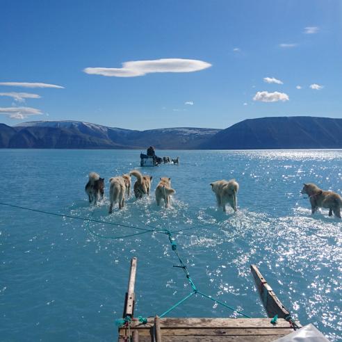
Due to the very difficult ice conditions and the ongoing COVID-19 pandemic, the exchange plans and expedition had to be changed and adapted. Right now, the leg three and four exchange is happening at a Spitsbergen fjord before the experiment can continue into the winter to summer transition and the summer period. After the exchange, the Polarstern will return to the experiment site and continue the drift.
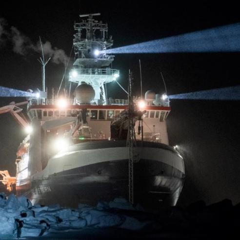
The experiment will end in October with leg six, when the freeze-up sets in after the summer melt. Polarstern, the German ice breaker, is the drifting research platform used for the international experiment whilst anchored to a second-year ice floe. Second-year ice is ice that has survived just one summer. Around the second-year ice floe, there is a matrix of first-year ice that started forming when Polarstern anchored to the floe in early October, or in cracks and leads that formed later during the winter. The ship and sea ice floe drift along with the wind and currents across the 4km-deep Arctic Ocean in the transpolar ice drift from Siberia, towards Fram Strait across the North Pole. The expedition reached its northernmost latitude at 88°36’ on 24 February 2020, only 156km from the pole.
The measurement programme is extensive; in addition to the measurements of the ocean beneath the ice, the ice and snow, the atmosphere, the bio-geo-chemical cycle and ecology, there are also a number of radiometer and radar remote-sensing instruments installed on the ice, representing the current and future satellite instruments for ice monitoring.
The data and knowledge collected during the MOSAiC campaign will be actively used within the OSI SAF development of existing products, i.e., sea ice concentration, sea ice emissivity, sea ice type, and sea ice temperature. While the remote-sensing instruments on the MOSAiC ice floe measure at near distance of the surface, the central parameters affecting the emission and scattering from the snow and ice, i.e. snow microstructure and density, stratigraphy, vertical temperature profile, salinity of the snow and ice, and surface roughness, are also sampled. These specialised measurements serve several needs at the OSI SAF:
- The uncertainty in sea-ice concentration estimates at synoptic and climate time scales. This helps, for instance, to answer the question about what happens to the Climate Data Record (CDR) uncertainties when multiyear-sea ice is replaced by first-year sea ice;
- The estimation of emissivity’s and emitting temperatures in application to atmospheric sounding over sea ice;
- Uncertainty in ice surface temperature estimation and the spatial variability of the surface temperature on the centimetre scale, affecting the heat transfer processes on the kilometre scale measured by satellites;
- The development of an observation operator for assimilation and inversion of satellite radiances into physical properties of the sea ice and the atmosphere above it, e.g., sea ice snow cover and tropospheric temperature. An observation operator is a model that can translate the measurements onboard the satellite to physical properties of the snow, ice, and atmosphere, and it is needed when satellite data are assimilated into weather prediction, sea ice, and ocean models.
In January 2018, the European Centre for Medium-Range Weather Forecasts (ECMWF) held a workshop on: “Observations and analysis of sea-surface temperature and sea-ice for Numerical Weather Prediction and Climate Applications”. The motivation for the workshop was to “…discuss the way forward for the use of observations of sea-surface temperature and sea-ice in numerical weather prediction and climate re-analyses applications, and to advise the ECMWF on how to best exploit the observational information.”
The outcome of the workshop is described in the workshop report, listing the recommendations on how to proceed during the next 10 years in:
- Coupled model development;
- The development of assimilation methods;
- The use of remote sensing observations.
Owing to the sea-ice theme present in the workshop, the focus was on polar predictions.
The first of the overarching recommendations from the workshop report explain that the ECMWF is moving towards a fully coupled ocean-ice-atmosphere model system and that their use of satellite data, in particular for sea-ice and sea-surface temperature, will change:
“the ECMWF was encouraged to follow an evolution towards the assimilation of microwave radiances (brightness temperatures) for the constraint of sea surface-temperature and sea-ice in the context of running fully coupled systems, and this will require extensive collaboration with space agencies and experts outside the ECMWF.”
These experts include the EUMETSAT OSI SAF team, who now provide sea-ice data for the ECMWF analysis and to other users.
According to the workshop report, the way the models use satellite data in the future will change from the assimilation of products like sea-ice concentration, to the direct assimilation of satellite radiances in the model by using an observation operator. Developing such an operator requires data such as those collected during the MOSAiC campaign, where the radiances or backscatter are measured together with the snow and ice thickness, salinity, structure, etc.
In any case, it will take time before the modelling centres are ready for assimilating satellite radiances for surface analysis, and it will also take time to develop an observation operator. Also, there is still a need for traditional sea-ice satellite products such as those provided today by the OSI SAF, but MOSAiC is collecting data that will secure the OSI SAF in the future.
Many thanks to Rasmus for this insightful explanation as to how the OSI SAF will benefit from and use the data observed during the MOSAiC expedition.
For more on the work of the OSI SAF, visit their website. You can also stay updated with the ongoing MOSAiC expedition via their dedicated website here.