TEST - EUMETSAT Meteorological Satellite Conference 2026
Darmstadt, Germany 21 – 26 September 2026
First Announcement and Call for Papers

The 2026 EUMETSAT Meteorological Satellite Conference will take place in Darmstadt, Germany on 21 to 25 September.
Session topics
The Organising Committee has consolidated the following themes:
1. Preparing for the utilisation of new generation GEO and LEO satellite data: algorithms to validation
The EUMETSAT new-generation fleet is now becoming a key asset for operational Earth observations. This session aims to assess satellite products and their initial use in different application areas. By 2026, we expect a consolidated analysis of Meteosat 12 and of the Arctic Weather Satellite, as well as an initial assessment of the first EUMETSAT polar system and the EUMETSAT geostationary hyperspectral sounder. The Copernicus Sentinel missions focusing on atmospheric composition capabilities and altimetry applications will be further explored. Finally, we intend to explore synergies across missions, with a dedicated focus on the EUMETSAT-NOAA joint polar satellite system.
We welcome abstracts around the following seven key blocks:
- 1.A – MTG-I operational products and new developments
- 1.B – Early Metop-SGA products and future considerations
- 1.C – New atmospheric composition capabilities
- 1.D – Microwave imaging and sounding - present and future missions
- 1.E – Altimetry (ocean, land, coastal, ice)
- 1.F – Towards operationalisation of synergy products (multi-instrument, multi-platform and fusion)
- 1.G – EUMETSAT-NOAA joint polar satellite system
2. From climate science to services: exploitation of satellite data for new products and services
This session focuses on the critical journey from raw Earth observation data to actionable climate intelligence. The session will explore the contribution of different missions, from EUMETSAT, Copernicus and international partners, to monitor the carbon, energy and water cycles. This will allow the community to review key operational contributions to greenhouse gas monitoring, such as CO2M and other missions, top of the atmosphere energy budget or water resources. It will cover also the generation of Fundamental and Climate Data Records, their application in different value chains, and the co-creation process with end-users to ensure products directly inform climate services and policy.
- 2.A – Global carbon, energy and water cycles: the contribution of EUMETSAT, Copernicus and international partners
- 2.B – Data rescue, Fundamental Data Records and their usage
- 2.C – Climate Data Records and information products and their usage
- 2.D – Co-creation of climate products with climate services and policy making
3. Enabling seamless prediction: from minutes to seasons
This session examines how satellite observations enable seamless prediction systems across all timescales. A core focus is quantifying the impact of this data on forecast skill and translating these advancements into actionable, sector-specific predictions for managing wildfires, energy grids, aviation, and other critical applications.
- 3.A – Satellite data use in seamless prediction from nowcasting to seasonal prediction
- 3.B – Impact assessment of observational data
- 3.C – Prediction for key sectors: wildfires, energy, aviation and other relevant applications
4. Preparing for the future: evolution of needs and technology trends guiding the design of satellite measurements
This session delves into the evolving landscape of technology trends in the space sector, with a forward-looking approach to the next 25 years. Key discussions will include a foresight session by invitation. Furthermore, participants will explore instrumental trends and the readiness of different solutions. Additionally, the session will address cloud and digital trends that can be critical to building future ground segments.
This session will comprise three key blocks with abstracts and presentations covering:
- 4.A – Foresight session by invitation
- 4.B – Planned and future mission concepts and instrument technology trends
- 4.C – Data access, cloud ecosystems and ground-segment technologies
5. Satellite observations and products for the ocean-atmosphere-land-ice interfaces
This session focuses on the critical zones where Earth's major systems interact: the ocean-atmosphere, land-atmosphere and ice-atmosphere interfaces. We will explore the latest satellite observations and derived products that monitor these dynamic surfaces (land, ocean, cryosphere) and the Planetary Boundary Layer (PBL)—the turbulent atmospheric layer directly influenced by them. Presentations will cover how this data is revolutionising our understanding of energy, moisture, and momentum exchanges, which are fundamental to weather, climate, and environmental forecasting.
- 5.A – Surface interfaces: (land, ocean and cryosphere)
- 5.B – Planetary Boundary Layer
6. European and international coordination of satellite operational initiatives
This session provides insight into the coordination of European and international operational satellite initiatives, set within the broader framework of key global coordination mechanisms such as the Committee on Earth Observation Satellites (CEOS), the Coordination Group for Meteorological Satellites (CGMS) and other international networks. We will invite operational agencies and leading research institutions to present their current and future horizons for environmental satellite programmes. A core focus will be on discussing how these entities interact and align their efforts—both with each other and within these vital international forums—to address global environmental and climate monitoring challenges. The first day's introductory session will provide a comprehensive overview of national, European, and international Earth observation programmes, establishing the foundational landscape for these discussions.
- 6.A – 40 years of collaboration with EUMETSAT – international partners
- 6.B – International and European EO coordination mechanisms
Special workshops and trainings will be organised throughout the conference week (1-2 hours per day). The training programme will focus on present and future satellite products to ensure that participants gain a comprehensive understanding of satellite data, as well as their application. More information about the trainings and workshop will be shared with the second announcement in mid-May 2026.
Abstract submissions
We invite you to submit an abstract for either an oral or a poster presentation. Posters will be displayed for the entire duration of the conference, with dedicated viewing times included in the programme.
Poster presenters will also have the opportunity to introduce their work orally to the full session audience during dedicated Poster Lightning Sessions.
Abstract submission will be open from 13 January 2026
Submission deadline is 8 February 2026
Abstracts should be submitted in English and be no longer than one page (A4). In the event of multiple authors, we kindly ask for one coordinated response. Please note that the person who submits the abstract will automatically be identified as the presenter and point of contact for future correspondence.
Each session theme will be assigned a panel of experts, constituting the Scientific Programme Committee (SPC), whose task will be to review abstracts for inclusion in the conference programme. Authors of selected abstracts will be notified (via e-mail) in mid-April 2026.
Registration fees
Specific details on registration fees, deadlines and payment will be provided in the Second Announcement mid-May.
Early Career Scientist Initiative
EUMETSAT is committed to supporting the scientists of the future and invites applications for our Early Career Scientist Initiative. Applications are open to anyone aged 32 or younger with up to 24 months of professional experience. Eligible papers should focus on the use or application of EUMETSAT satellite data within the main themes of the conference.
During the conference week, the Scientific Programme Committee will select five papers—oral or poster presentations—to receive an award consisting of travel funding and free participation in the 2027 EUMETSAT Meteorological Satellite Conference. The selected 2026 papers will be recognised during the conference’s closing ceremony.
Venue
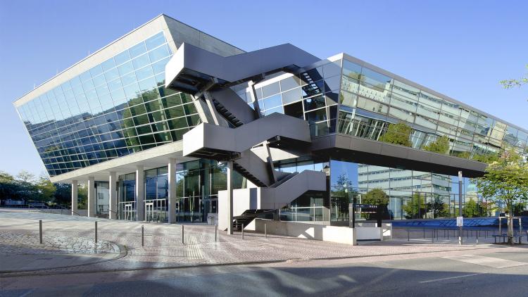
The venue for our conference is the Darmstadtium Congress Centre, offering modern conference facilities and generous exhibition and foyer spaces. Built upon a historical fortification from the 14th century, it merges the modern with ancient history and is located in the heart of Darmstadt.
Darmstadt is a vibrant city in the state of Hesse, Germany. Known as the "City of Science" (Wissenschaftsstadt), it hosts numerous scientific institutions, universities, and high-tech companies.
The city also boasts a rich cultural heritage, especially through the Mathildenhöhe, a UNESCO World Heritage Site and former artists' colony that played a key role in the Jugendstil (Art Nouveau) movement. Darmstadt combines historic charm with modern innovation, making it a unique destination for both research and culture. Our networking events will take place at the Darmstadtium and at the Central Station, an event and concert location central to Darmstadt’s tradition.
Sponsors
EUMETSAT offers interesting sponsorship options. If your institution is interested in sponsoring the conference, please contact @email for details.
About EUMETSAT
The European Organisation for the Exploitation of Meteorological Satellites is an intergovernmental organisation based in Darmstadt, Germany, currently with 30 Member States: Austria, Belgium, Bulgaria, Croatia, Czech Republic, Denmark, Estonia, Finland, France, Germany, Greece, Hungary, Iceland, Ireland, Italy, Latvia, Lithuania, Luxembourg, the Netherlands, Norway, Poland, Portugal, Romania, Slovakia, Slovenia, Spain, Sweden, Switzerland, Turkey and the United Kingdom.
EUMETSAT operates the geostationary satellites Meteosat-10 and -11 over Europe and Africa, and Meteosat-9 over the Indian Ocean. EUMETSAT also operates two Metop polar-orbiting satellites as part of the Initial Joint Polar System (IJPS) shared with the US National Oceanic and Atmospheric Administration (NOAA).
In addition, EUMETSAT is a partner in the cooperative high precision ocean altimetry Jason missions involving Europe and the United States (Jason-3 and Sentinel-6 Michael Freilich).
The data and products from EUMETSAT’s satellites are vital to weather forecasting and make a significant contribution to the monitoring of environment and climate change. The European Union has entrusted EUMETSAT with exploiting the four Sentinel missions (Sentinel-3, -4, -5 and -6) of the Copernicus space component dedicated to the monitoring of atmosphere, ocean and climate on its behalf. EUMETSAT will carry out these tasks in cooperation with ESA. EUMETSAT has established cooperation with operators of Earth observation satellites from Europe and China, India, Japan, Russia, South Korea and the United States.
In addition, Météo-France is also involved in the implementation of operational services in the context of the EU Copernicus programme.