28 March 2023
28 July 2022
EUMETSAT manages the operations of Ocean Colour products derived from the Ocean and Land Colour Imager (OLCI) instrument flown on the Sentinel-3 satellites from the European Commission Copernicus Programme. Ocean Colour System Vicarious Calibration (OC-SVC) with radiometric measurements at sea is required to achieve the quality of the Ocean Colour products defined in the mission requirements. OC-SVC requires a dedicated infrastructure at a favourable location. EUMETSAT has initiated activities on behalf of the EC to investigate the Copernicus OC-SVC infrastructure.
This study is part of a survey to find the best location for potential Copernicus OC-SVC infrastructure in European waters in terms of atmospheric, oceanographic and logistical site characteristics. The study follows Phase-1 and Phase-2 activities of the Copernicus OC-SVC roadmap and precedes the proposed Phase-4 activity. Phase-1 and Phase-2 were respectively the Scientific, Technical and Operational Requirements, and the Preliminary Design, Project Plan and Costing. The proposed Phase-4 is the Technical Definition, Specification, and Detailed Design study.
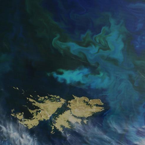
This study climatologically characterised three sites around the island of Crete (Greece) in terms of multiple atmospheric, oceanographic and other relevant parameters, in order to confirm the prime suitability of the region of Crete in the Eastern Mediterranean as the location for the Copernicus OC-SVC infrastructure.
A site in the waters near Crete has been suggested by the global evaluation work of Zibordi and Mélin (2017) and Zibordi et al. (2017) as the best region in the European Seas for ocean colour system vicarious calibration. In particular, they state in Zibordi et al., 2017:
"Zibordi and Mélin (2017) came to the conclusion that the analysis on potential high quality matchups confirms the superior location of the MOBY site in the Northern Pacific Ocean (NPO) for SVC. While recognizing that no site is superior for all criteria reviewed in the analysis, it nonetheless suggests that the Eastern Mediterranean Sea near the Island of Crete exhibits best equivalence with NPO and could be considered a suitable choice for a European SVC complying with requirements for the creation of CDRs."

Crete locations: MSEA-N: 35.74N, 25.07E; MSEA-S: 34N, 25E; Antikythera: 36.2N, 23.55E
Objectives
The main objectives of the study were to assess and document relevant atmospheric and oceanographic environmental characteristics for three sites around Crete, and help to identify an optimal location for a Copernicus infrastructure dedicated to Ocean Colour System Vicarious Calibration (OC-SVC).
Overview
In order to fully characterise the three sites around Crete, the following atmospheric, oceanographic and other environmental parameters were assessed in detail and separately for each site:
- Geography: site locations relative to land, bathymetry, sea bottom depth, and solar illumination conditions at the time of the Sentinel-3 overpasses.
- Atmospheric characterisation and mapping: fractional cloud cover, wind velocity and direction, aerosol type and optical thickness, and absorbing gases.
- Ocean characterisation and mapping: chlorophyll, AOP (remote sensing reflectance); IOP (CDOM absorption and particulate backscatter), currents, waves, SST/surface layer temperature, and salinity.
- Other: nearby shipping routes and monthly traffic (and associated map of NO2 concentration), nearby airline routes and monthly traffic, and fire occurrences in the surrounding areas (within 50km).
Additionally, a compliance matrix of each site with the environmental requirements specified in the Copernicus OC-SVC requirements document (Mazeran et al., 2017) was also produced with detailed analysis related to each parameter.
The main conclusions of the study were that the Crete sites have a calm and stable physical, biological and optical oceanographic environment, a clear sky, and a cloud free atmosphere at a higher frequency than anywhere else in European waters. This has been shown to translate to the best available equivalence in Europe to the USA’s operational MOBY site near Hawaii (Zibordi and Mélin, 2017) with the potential to provide the same number of high-quality, low-uncertainty matchups with Sentinel-3 OLCI (Antoine et al., 2020) that is crucial for successful OC-SVC. Along with the nearby extensive supporting oceanographic infrastructure that the HCMR-Crete headquarters provides (including calibration laboratories and large research vessels) and the nearby international atmospheric monitoring reference stations on Crete and Antikythera (part of the PANACEA network), these facts demonstrate full compliance with OC-SVC requirements (Mazeran et al., 2017) and reconfirm Crete’s excellent suitability for the new Copernicus OC-SVC buoy and associated infrastructure.


References
Antoine, D., Vellucci, V., Banks, A.C., Bardey, P., Bretagnon, M., Bruniquel, V., Deru, A., Fanton d’Andon, O.H., Lerebourg, C., Mangin, A., Crozel, D., Victori, S., Kalampokis, A., Karageorgis, A.P., Petihakis, G., Psarra, S., Golbol, M., Leymarie, E., Bialek, A., Fox, N., Hunt, S., Kuusk, J., Laizans, K., and Kanakidou, M. (2020). ROSACE: A proposed European Design for the Copernicus Ocean Colour System Vicarious Calibration Infrastructure. Remote Sensing 12, 1535. https://doi.org/10.3390/rs12101535
Liberti, G.L., D’Alimonte, D., di Sarra, A., Mazeran, C., Voss, K., Yarbrough, M., Bozzano, R., Cavaleri, L., Colella, S., Cesarini, C., Kajiyama, T., Meloni, D., Pomaro, A., Volpe, G., Yang, C., Zagolski, F., Santoleri, R., (2020). European Radiometry Buoy and Infrastructure (EURYBIA): A Contribution to the Design of the European Copernicus Infrastructure for Ocean Colour System Vicarious Calibration. Remote Sensing 12(7), 1178. https://doi.org/10.3390/rs12071178.
Mazeran et al., (2017). Requirements for Copernicus Ocean Colour Vicarious Calibration Infrastructure (EUMETSAT study report, EUMETSAT, Darmstadt, Germany). https://www.eumetsat.int/media/42725
Zibordi, G. and Mélin, F. (2017). An evaluation of marine regions relevant for ocean color system vicarious calibration. Remote Sensing of Environment 190, 122–136. https://doi.org/10.1016/j.rse.2016.11.020
Zibordi, G., Mélin, F. and Talone, M. (2017). System Vicarious Calibration for Copernicus Ocean Colour Missions: Requirements and Recommendations for a European Site (Publications Office of the European Union: Brussels, Belgium). https://publications.jrc.ec.europa.eu/repository/bitstream/JRC105497/kj-na-28433-en-n%20pdf.pdf