
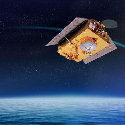
Copernicus Sentinel-6
A cooperative project to monitor Earth’s oceans

The ramifications of the effects of climate change on the Earth’s oceans are clearer this week with the release of the Intergovernmental Panel on Climate Change’s latest report.
27 April 2021
24 September 2019
At the same time, however, European and United States agencies are working together to ensure climate scientists and policy makers have access to accurate and verifiable data on which to base mitigation and adaptation policies into the future.
The IPCC report

The IPCC is a United Nations body with 195 member countries. Its Special Report on the Ocean and Cryosphere in a Changing Climate sets out stark scenarios for how climate change is impacting the “blue planet’s” oceans.
Among its many findings, the report states that it is virtually certain that the global mean sea level will continue to rise throughout the 21st Century and beyond. Furthermore, it finds that the rate of increase in sea level is very likely to be faster than that of last century’s.
The report’s authors relied on numerous studies and sources of data to come to its conclusions.
Among those sources were data from the joint European-United States Jason high-precision satellite altimetry missions .
Toward the Copernicus Sentinel-6 era
European and United States agencies are now preparing for the next generation of this altimetry mission, which will be known as Copernicus Sentinel-6 . The first of the Sentinel-6 satellites is scheduled for launch in late 2020.
“Close cooperation between Europe and the United States over more than 30 years underpins the Jason missions, which have provided data critical for understanding our changing climate, as well as for weather forecasting,” EUMETSAT Head of Strategy, Communication and International Relations Paul Counet said.
“In fact, Jason altimetry data was used extensively in the IPCC special report.
“The Copernicus Sentinel-6 mission continues the international, cooperative association as we now enter an era of consequences and responsibility when it comes to climate change.”

A Copernicus Sentinel-6 spacecraft in the Airbus clean room at Friedrichshafen
Measuring sea level rise
EUMETSAT Copernicus Sentinel-6 Programme Manager Manfred Lugert said the mission will provide highly accurate ocean altimetry data required for monitoring mean sea level rise into the future.
“Copernicus Sentinel-6 will be the reference mission for other ocean altimetry missions,” Lugert said. “This means that other agencies’ satellite altimetry missions will cross-calibrate their measurements against those of Sentinel-6 to ensure their accuracy.”
Mean sea level rise is an indicator and consequence of climate change.
“Provision of highly accurate data is crucial for developing mitigation and adaptation policies, as well as increasing our knowledge and understanding of climate change,” Lugert said.
“To detect and monitor changes in climate, long time series of homogenous data are required.”

The image above shows the altimeter-derived sea level time series from 12 different altimeter missions, of which six are still operating
History of high-precision ocean altimetry
The high-precision ocean altimetry data time series began in 1992 with the launch of the TOPEX/Poseidon mission (1992-2006) and was continued by Jason-1 (2001-2013), Jason-2 (2008-2019), and Jason-3 (launched in 2016).
The Copernicus Sentinel-6 mission will ensure this time series continues until at least 2030, through two successive satellites, Sentinel-6A and -6B.

Artist’s impression of Jason-3 in orbit
European-US cooperation
Lugert said the Copernicus Sentinel-6 mission is a partnership between EUMETSAT, the European Commission , the European Space Agency (ESA), NASA and the US National Oceanic and Atmospheric Administration (NOAA).
“EUMETSAT will operate the satellites and process and disseminate the altimetry data,” Lugert said. “But the mission is only possible with the contributions of each of the partners.”
The international partnership behind the project first involved NASA and the French Space Agency CNES, through the TOPEX-Poseidon mission . NOAA and EUMETSAT became involved when the mission gained operational status with Jason-2.
The Jason-3 mission also involved the European Union, which funds its European operations through the Copernicus Earth observation programme. ESA also contributed financially to the Jason-3 mission.
The European Commission, EUMETSAT and ESA are co-funding the European contribution to the Copernicus Sentinel-6 mission. ESA is managing the development of the spacecraft, which are being built by Airbus.
NASA is responsible for providing the launch service for the satellites as well as three of the payload instruments, and will support the operations and data processing for those instruments.
NOAA provides a ground station for down-linking the data and is responsible for disseminating data to US users.
Looking ahead
The findings of the IPCC special report reinforce the importance of the Copernicus Sentinel-6 mission.
Copernicus Sentinel-6A is scheduled for launch on a SpaceX rocket from Vandenberg Air Force Base in California in November 2020.
EUMETSAT will provide news and regular updates on our Copernicus Sentinel-6 internet pages .
Looking back
EUMETSAT Copernicus Sentinel-6 Project Scientist Remko Scharroo said other satellite altimeter missions, besides the TOPEX and Jason series, have contributed to the monitoring of sea level rise from space.
“Together, they paint a picture of a sustained increase in the mean sea level of about 3.1mm per year,” Scharroo said.
“About one-third can now be attributed to expansion of the oceans by heating and the other two-thirds to the addition of water through melting glaciers and increased run-off.
“On top of that, we see some decadal variations, which can be largely attributed to large-scale ocean phenomena like El Niño.”
* In January 2020, the Sentinel-6/Jason-CS A satellite was renamed the Sentinel-6 “Michael Freilich” in honour of the former Director of NASA’s Earth Science Division.