
New satellite ground station in Switzerland inaugurated today
This ground station is a key component for the success of EUMETSAT’s next satellite system

EUMETSAT chatted with head of MeteoSwiss Regional Centre South, Marco Gaia, about how weather and climate data from revolutionary next-generation satellites, Meteosat Third Generation, will benefit Switzerland.
01 November 2023
06 May 2022
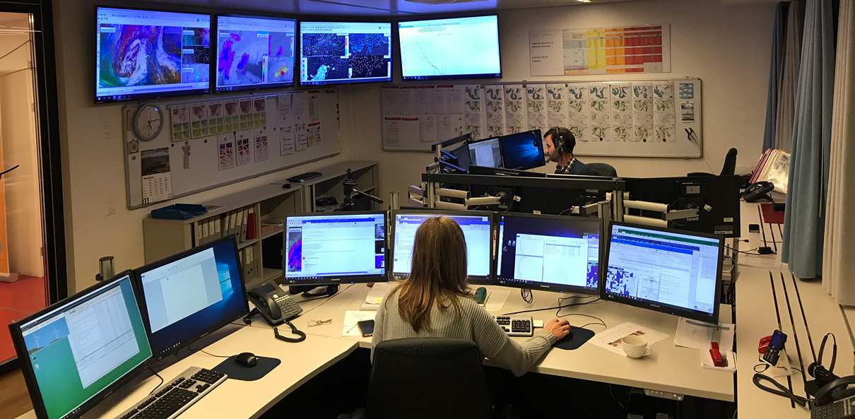
Today, EUMETSAT’s newest ground station for Meteosat Third Generation satellites in Leuk, Switzerland has been inaugurated. This is one of four ground stations that will be used for the series of revolutionary Meteosat Third Generation satellites, the first of which is set to launch this winter.
EUMETSAT spoke with Marco Gaia, the head of MeteoSwiss Regional Centre South, Switzerland’s national weather and climate service, about what the ground station is, how Switzerland will benefit from the data from these new satellites, and the importance of international cooperation for meteorology.

EUMETSAT:
First things first – what is this ground station?
Marco Gaia:
This ground station is the collection point of satellite information from the new Meteosat Third Generation satellites. The satellites will make various observations from their location 36,000km above Earth and they will send this information to Earth. This ground station, which consists of three antennas, is one of two entry points for receiving the data from space. The other entry point is a duplicate ground station, located on the northern part of Lake Como, in Lario, Italy. The benefit of having two ground stations collecting satellite data is to decrease the probability of bad weather disturbing both antennas simultaneously.
EUMETSAT:
Let’s talk about the how data from the new generation of satellites will help meteorologists monitor and forecast one particularly difficult weather phenomenon: thunderstorms. What improvements do you anticipate for Switzerland?
Marco Gaia:
Thunderstorms are very speedy phenomena – they can develop very abruptly. Although we have some instruments on the ground that we can use to detect thunderstorms, they mainly measure rainfall. So, without rain, we can’t really detect thunderstorms and, in most cases, by the time rain is falling, the thunderstorm has already developed.
With satellites, though, we are able to anticipate a thunderstorm because we can observe a cumulus cloud from the beginning of its life cycle, even before it produces rain. Used in conjunction with other atmospheric information, such as temperature and relative humidity profiles, this information can help meteorologists better forecast thunderstorms, even when the skies are almost clear.
This is important for Switzerland because it’s such a mountainous country. Sometimes, when a thunderstorm develops behind a mountain, you can only see it with your eyes at the last moment. With satellites, however, we are able to see thunderstorms moving even behind mountains. We are looking forward to receiving more frequent satellite data from MTG that will allow us to gain critical minutes when forecasting thunderstorms, which can save lives, particularly when the thunderstorms are severe.
The lightning imager, an instrument that hasn’t been flown yet on any of the previous Meteosat satellites, will enable forecasters to monitor the atmosphere in the middle of the Atlantic Ocean. This is critical information for pilots flying to the United States and important for Switzerland because the weather here is very much influenced by the atmospheric conditions over the Atlantic. When I work as a meteorologist on duty, this information will give my colleagues and me the opportunity monitor developments in the atmosphere with significantly better spatial and temporal resolution.
EUMETSAT:
Who benefits most from improved thunderstorm forecasts?
Marco Gaia:
Although very local phenomena, thunderstorms can cause a lot of damage. Air traffic controllers can use thunderstorm nowcasting warnings – immediate weather forecasts – to reroute flights in order to avoid thunderstorms and, in turn, protect passengers. The ground operations at airports, such as refuelling airplanes, are also affected by weather conditions, so precise thunderstorm forecasts are essential to optimise processes and save money. In addition, an approaching thunderstorm can threaten people hiking or climbing in the Alps. And last but not least, during the summer in Switzerland, we have a lot of open air events including concerts and sporting events that attract big crowds – often as many as five to ten thousand people might attend one of these events. Accurate, timely, and precise thunderstorm forecasts could greatly protect the security of these attendees.
EUMETSAT:
How will data from these new satellites help meteorologists better forecast fog, another troublesome weather phenomenon in Switzerland?
Marco Gaia:
Fog is not a weather phenomenon that you find only in Switzerland. But it is particularly problematic for the air traffic controllers at the two major airports here. Of course, technology makes it possible for planes to take off or land without good visibility but, if it’s really foggy, an airport can’t accept the same rate of flights taking off or landing as it can when there are clear skies. So receiving more accurate fog forecasts will enable air traffic controllers to better plan their schedules. This improvement in forecasting will be possible thanks to the better spatial and temporal resolution of data that Meteosat Third Generation satellites will provide.
EUMETSAT:
Very useful. Can you please explain how MeteoSwiss benefits from being a partner of the EUMETSAT Satellite Application Facility on Climate Monitoring (CM SAF), an international consortium of organisations that uses satellite data for climate monitoring and research?
Marco Gaia:
Now, more than ever, it is important to closely monitor the climate. One project we worked on through the CM SAF was a project to calculate solar radiation maps for Switzerland. We developed special algorithms to generate very precise solar radiation data for mountains and over snow-covered surfaces. Those data were then passed along to the Swiss Federal Office of Energy and the Federal Office of Topography who added additional information, including each roof’s exposure – north, south, east, west – and processed the data in order to produce maps showing the solar energy potential for each roof in the country. This project demonstrated that a public end user application of satellite data requires many more steps than just producing and documenting the data. We also learned how open government data can generate added socio-economic value.
Our current focus is to use forty years of recalibrated satellite data to track the surface energy balance, which is the exchange of energy between the Earth’s surface and the atmosphere. In Switzerland, we have four ground sites measuring surface energy balance, which provide invaluable information about climate variability. But because it is not possible to operate the same kind of ground site in the mountains, since these sites require heavy equipment and are difficult to maintain under extreme weather conditions, we rely on satellites to monitor climate variability there. These data are very important to precisely model processes such as the melting of glaciers in Switzerland. In addition, knowing the surface energy balance will also enable us to study heat waves and droughts from space.
The new third generation of Meteosat satellites will record spatial and temporal changes in extreme weather events in Switzerland. The measurements of previous Meteosat sensors will be continued with high precision, thus enabling the long-term monitoring of important climate measurement series in Switzerland.
EUMETSAT:
That sounds like a really interesting, forward-thinking, and truly collaborative project! Being open and collaborative is really key in meteorology and climatology.
Marco Gaia:
I feel excited by this inauguration because it is an opportunity to remind people how important international cooperation is for meteorology and how important it is for Switzerland, one of EUMETSAT’s original member states, to be a part of this. International cooperation has made all of the invaluable Meteosat satellites possible.
The main takeaway I’d like to leave readers with is that weather knows no borders. Similarly, the meteorological community should continue to cooperate beyond borders in order to most effectively protect society from dangerous weather events.
Author:
Sarah Puschmann