Meteosat Third Generation: The eyes on a storm
Météo-France’s Sylvain Le Moal on preparations for Meteosat Third Generation.

How EUMETSAT’s Nowcasting Satellite Application Facility is preparing for the launch of Meteosat Third Generation spacecraft

14 February 2025
18 October 2022
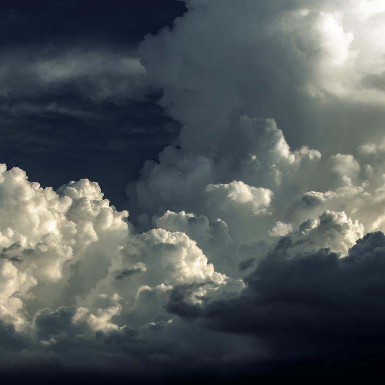
On 9 October 2018, torrential rain and thunderstorms laid siege to a mountainous region in north-east Mallorca, Spain, killing 13 people and affecting thousands more.
Flash floods tore through roads, bridges, houses, and farmland on the Balearic island, while people were stranded on rooftops or trapped in free-floating cars.
Weather stations in some villages recorded nearly four weeks’ rainfall in just one hour. The town of Arta received four months’ precipitation in a day. It was the deadliest meteorological event to hit the island in decades.
Forecasters had predicted storms in a region prone to convective activity: what they had not foreseen was the sheer scale of events and their harrowing consequences.
“Despite major advances in weather forecasting capabilities over past decades, the impacts of storms at very local levels remain notoriously difficult to predict,” explains Pilar Rípodas, a meteorologist at Spain’s national meteorological agency (AEMET) and project manager of EUMETSAT'S Satellite Application Facility for Support to Nowcasting and Very Short Range Forecasting (Nowcasting SAF).
“In Mallorca, the land rises steeply from the coastline, and when high winds combine with the uplift of warm, wet air masses from the Mediterranean, this can quickly create conditions ripe for torrential downpours when they hit the island’s mountainous regions.”

Improving storm prediction means rising to key challenges, including increasing the amounts of meteorological data available in real time; improving understanding of the intricate roles played by factors such as cloud type, terrain, and ocean temperature; and making data accessible to forecasters in clear and effective ways.
“Ground-based weather stations are more often in and around urban areas, and therefore fewer data are typically available for rural regions or over the open ocean,” Rípodas says.
“Satellite data play a key role in filling in many of these gaps, but even then abrupt changes in precipitation, temperature, or wind speeds can be very difficult to foresee using mathematical models of the atmosphere and ocean that are used to predict the weather, known as numerical weather prediction models."
This is where nowcasting comes in.
"Nowcasting is a technique that combines near-real-time images and other data from satellites and ground-based instruments and uses this to extrapolate forward what will happen in the next hours,” Ripodas explains.
"We have to bring together data from different sources such as satellites, weather radar, wind profilers, lightning detectors, radiosondes, and weather models in order to build up a picture of the weather situation as it is now.
"These observations do not always fit together in exactly the same place or time, so therefore satellite data are not only essential for direct and indirect observations, but also for validating data from other instruments."
Rípodas points out it is also necessary to account for inherent uncertainties.
"A weather system conducive to thunderstorms might be moving northeast, but it may not be clear if it will change direction," she says.
"If it does, what will happen? Will it strengthen? Weaken? The nowcaster has to consider the terrain, the atmospheric conditions, and many other variables over very short timescales."
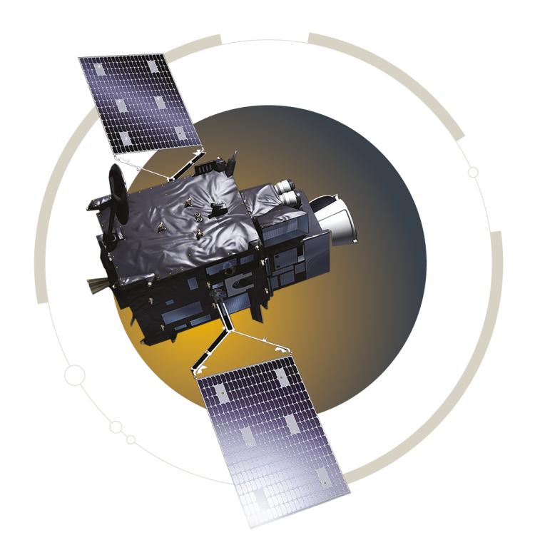
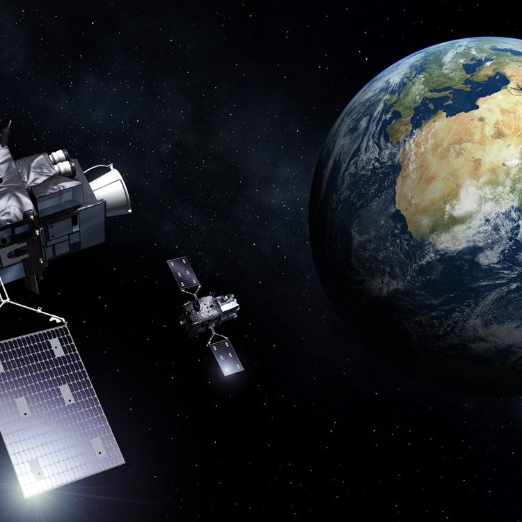
The accuracy of nowcasting in Europe and Africa is set to receive a major boost with the upcoming launch of EUMETSAT’s Meteosat Third Generation (MTG) geostationary satellite constellation.
From a vantage point 36,000 kilometres above the Earth’s surface, MTG's imager and sounder satellites will provide more than 50 times more data than existing Meteosat satellites, up to every two-and-a-half minutes.
MTG observations will shine a light on everything from the nature of clouds, to the temperature of different atmospheric layers, to the frequency of lightning flashes – factors that can help forecasters quickly spot the signs of storm development.
“Nowcasting is reliant on the timely supply of vast quantities and types of real-time data,” Rípodas says.
"Teams across Europe, including here at AEMET and EUMETSAT's Nowcasting SAF, have been working for a long time on getting ready.
“Now, with the launch of MTG's first imager satellite by the end of this year, we are very close to the time when we will start seeing the results.
"For the first time, MTG will provide meteorologists with a 3D representation of the atmosphere thanks to vertical measurements taken of temperature and water vapour. There will also be vital new data types such as satellite-derived lightning images.
“The challenge, then, is to take this data and turn it into nowcasts by making use of it in an effective, efficient, and timely way.”
To be as prepared as possible for MTG, AEMET has been updating infrastructure, refining software, and preparing training courses for users such as forecasters, transport planners, and emergency response teams.
“One important step has been the establishment of a new reception station for EUMETCast, EUMETSAT'S data dissemination system," says Dr Xavier Calbet, from AEMET, who is Scientific Coordinator of EUMETSAT’s Nowcasting SAF.
"Because the amount of available data will increase so much, it's essential we not only download it, but also ensure that the products and services used to make the data accessible to end users are updated.”
This is one of the central goals of EUMETSAT'S Nowcasting SAF, which develops software packages and satellite products that are used across Europe and the world for everything from thunderstorm prediction, to wind speed measurement, to cloud identification (see boxed text).
"Maintaining and improving products currently available for Meteosat missions is the number one priority," says Calbet. "But MTG will also open up the possibility for new products and services, for instance, based on the lightning imager’s sensor activity."
There is also potential to improve many other types of meteorological observations.
One of the main beneficiaries could be convective initiation products, which rely on observations of cloud movement, and dynamics.
"Meteorological radar instruments usually measure rainfall, rather than clouds themselves," Calbet explains. "That means once you detect something on the radar, it is already raining at that spot – too late for nowcasting into the future.
"With sweeping views over the Earth, satellites can help fill this gap. But the challenge for satellite-based cloud observations is that it is very difficult to identify which clouds could become associated with severe weather.
"But thanks to the quality and frequency of MTG data, it will be possible to make observations of fast evolving clouds: if clouds rapidly grow in size, we could be witnessing the very first stages of storm development.
"MTG data will allow researchers to study wind patterns on the top of cumulonimbus clouds or scan inside cumulus clouds to determine the size of cloud droplets and their movements. All of this data can contribute to significant improvements in nowcasting.”
Another priority for EUMETSAT’s Nowcasting SAF will be the development of services that combine data from various sources and products.
"Here, initiatives such as the European Weather Cloud will be invaluable for developing nowcasting tools based on a variety of data sources, both satellite and ground-based," Calbet says. “Better integrating these diverse data into products and services would be another big step forward in nowcasting.
"This could be particularly beneficial for the weather services of smaller European countries, and, given that MTG satellites are positioned over the equator, to compensate for lower resolution at higher latitudes.
"MTG data will open up a huge number of opportunities: I hope one day we can be even better prepared for disastrous weather events that affect Spain and every other country in Europe.
“Even with these new capabilities there is a lot to do – both technically and scientifically – to get the most out of the data. But we're ready for it."
"MTG data will allow researchers to study wind patterns on the top of cumulonimbus clouds or scan inside cumulus clouds to determine the size of cloud droplets and their movements. All of this data can contribute to significant improvements in nowcasting.”
EUMETSAT’s Nowcasting Satellite Application Facility develops a wide range of software packages and satellite products that are used the world over. Here are just a few of the highlights:

The Rapidly Developing Thunderstorm (RDT) product is used to detect, track, characterise, and forecast convective cells, important in identifying the early stages of storm development.

High Resolution Winds (HRW) tracks the movement of cloud and moisture in the atmosphere to fill gaps in wind speed observations, especially important over oceans and remote areas where observations from other areas are limited.

Convective Rainfall Rate is used to analyse the physical properties of clouds to predict rainfall, helping nowcasters to localise storm systems and see which areas will be affected by them – particularly important in remote areas not well covered by radar, such as mountains or open ocean.

Products such as Cloud Mask, Cloud Type, Cloud Top Temperature and Height, and Cloud Microphysics help support the integration of cloud observations into weather models and identify cloud attributes important, for example, for transport planning.