Taking stock of the global climate
Addressing essential climate variables.


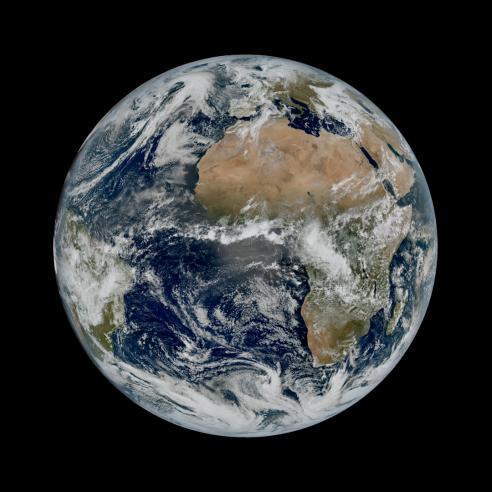
The Paris agreement might draw the limelight but another collaborative global effort is bringing crucial understanding to our planet’s changing climate.
And much of its focus is on space.
08 February 2021
01 December 2017
The ECV Inventory
In October, an inventory of more than 900 satellite data records addressing essential climate variables (ECVs) was made available to the public. It contains a massive amount of information provided by about 100 data producers using satellite data from many of the world’s space agencies. Fifty-three essential climate variables have been identified by Global Climate Observing System (GCOS) experts.
They include sea level, the temperature of the sea surface, the extent of sea ice, air temperature, ozone, aerosols (fine particles in the atmosphere), precipitation, and fire, to name just a few. This information is crucially important for applications supporting policy makers and researchers concerned with climate change and also for space agencies, as it supports planning of the future climate observing system.
Among the users of the inventory is Europe’s Copernicus Climate Change Service (C3S), which responds to environmental and societal challenges associated with human-induced climate changes and helps support adaptation and mitigation. Producing the inventory was a mammoth project undertaken by the joint Committee of Earth Observation Satellites (CEOS) and the Coordination Group for Meteorological Satellites (CGMS) Working Group on Climate (WGClimate).
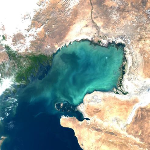
Global Sea Surface Temperature, 2016. Data: Copernicus Marine Environment Monitoring Service (CMEMS)
Alexandra Nunes, who works as a climate data inventory engineer on this project for EUMETSAT, explains. "The ECV Inventory is a public database of information about satellite-derived data records used to monitor the status of the global climate on Earth,” Alexandra said. “It aims to contain information regarding all of the existing, and planned, data records produced by, or under the responsibility of, space agencies worldwide.
“By doing this, it depicts the current and near-future status of climate-monitoring from space which is a major objective of the CEOS/CGMS Working Group on Climate. “It’s called an ECV Inventory because the datasets it contains address the GCOS ECVs, which are a set of geophysical, chemical and biological variables that crucially contribute to the characterisation of the variability and change of the Earth’s climate.”
What is being observed?
The definition of the GCOS ECVs is based not only on their relevance to the Earth’s climate but also on the feasibility and cost effectiveness of observing those variables on a global scale.
“The complexity of the climate system means monitoring on a global scale is of utmost importance,” Alexandra explained. “Space-based observations play a crucial role in achieving this by measuring around two-thirds of all of the ECVs.
“Although all of the ECVs need to be considered in order to attain a full picture of the global climate system, the ECV Inventory is focussed only on special datasets, the Climate Data Records (CDRs) addressing the ECVs observable from space. “Not all available datasets qualify as CDRs because climate change and variability signals are very small at decadal to centennial time scales.
“So there are very stringent requirements for consistency, continuity and length of the time series used to study the climate compared to the datasets used for monitoring the shorter-term variability related to weather, for example. “With some satellite observations spanning more than four decades, the value of the contribution of space-derived CDRs for climate change monitoring is undeniable.” EUMETSAT, which led the international effort to establish the inventory, contributed more than 25 percent of the entries. Copernicus Climate Change Service Deputy Head Dick Dee said the C3S relies on the GCOS ECV concept and associated CDRs. “The existence of a complete, accurate and up-to-date inventory of ECVs is essential for our purposes. “Several existing C3S contracts for development and quality assessment of CDRs include reference to the ECV inventory. In particular, all C3S data suppliers will be asked to make sure that their data records are accurately represented in the ECV inventory.”
Sea ice – an essential climate variable
Sea ice is a key indicator for climate variability and change in the polar regions. It strongly modifies surface waves and air-sea exchanges of heat, moisture and gases, impacting the water masses, the properties below it, and influences how much solar radiation is reflected from the Earth’s surface into space. Satellite derived CDRs for sea-ice concentration are now available for a time series starting in 1978 and extending to the present.
Polar ice concentration of the northern and southern hemispheres throughout 2016, as seen by the DMSP and Metop satellites. Data: OSI SAF
One of these data records was produced by the EUMETSAT Ocean and Sea Ice Satellite Application Facility (OSI SAF), based on extensive and careful analysis and correction of the fundamental satellite observations that was done in the EUMETSAT Climate Monitoring Satellite Application Facility (CM SAF). The two SAFs are part of a Network of eight specialised Application Facilities (SAF Network) which is part of EUMETSAT’s distributed ground segment. You can find out more here.