


04 October 2023
06 April 2020
- China National Space Administration (CNSA)
- China Meteorological Administration (CMA)
- National Satellite Ocean Application Service of the Chinese State Oceanic Administration under the Ministry of Natural Resources (NSOAS of SOA, MNR)
- Environment and Climate Change Canada (ECCC)
- Indian Space Research Organisation (ISRO)
- Japanese Meteorological Agency (JMA)
- Japan Aerospace Exploration Agency (JAXA)
- Korea Meteorological Administration (KMA)
- US National Aeronautics and Space Administration (NASA)
- US National Oceanic and Atmospheric Administration (NOAA)
EUMETSAT also anticipates that the National Institute of Environmental Research (NIER) of the Republic of Korea will become a partner by mid-2020.
In addition, interaction with several of these partners takes place within multilateral frameworks, such as the Coordination Group for Meteorological Satellites (CGMS), the Committee on Earth Observation Satellites (CEOS), the Group on Earth Observations (GEO) and the World Meteorological Organization (WMO).
The cooperation with the Russian Federation, and the Russian Federal Service for Hydrometeorology and Environmental Monitoring (Roshydromet) was suspended in March 2022.
China National Space Administration (CNSA)

Through the signature of a framework agreement, the cooperation provides a long-term perspective for the further development of already existing partnerships with the China Meteorological Administration (CMA) and the Chinese State Oceanic Administration’s (SOA) National Ocean Satellite Application Centre (NSOAS).
In June 2019, EUMETSAT signed a trilateral agreement with the CNSA and the French National Centre for Space Studies (CNES) in order to secure the data from the Chinese-French Oceanography Satellite (CFOSAT).
For more information, please visit the CNSA website.
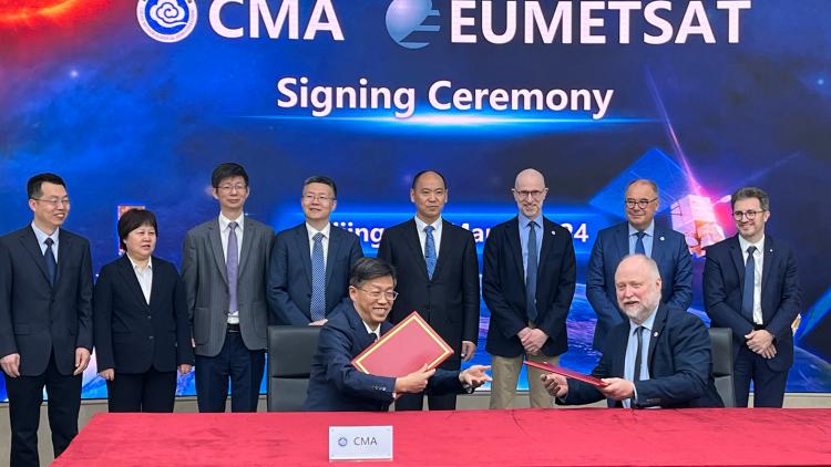
China Meteorological Administration (CMA)

EUMETSAT and the CMA have had a mutually beneficial cooperation since 1998, which initially focussed on operational scientific and training activities and has been strengthened over the years to include satellite data and product exchange, calibration and validation, and scientific activities.
Since 2014, EUMETSAT has hosted both short- and long-term CMA visiting scientists/technical experts at its headquarters in Darmstadt.
The operational data exchange enables the redistribution of EUMETSAT data and products to all countries in the Asia-Pacific area and Chinese data in Europe. The data dissemination systems EUMETCast and CMACast both contribute to the global satellite dissemination system GEONETCast, in support of the Global Earth Observation System of Systems (GEOSS).
National Satellite Ocean Application Service (NSOAS)

In 2012, EUMETSAT signed a cooperation agreement for the exchange of oceanographic satellite data between China’s National Satellite Ocean Application Service (NSOAS), an institute of the Chinese State Oceanic Administration (SOA) under the Ministry of Natural Resources (MNR).
The agreement further strengthens the cooperation with China and creates new opportunities for the oceanography user community. Under this agreement, EUMETSAT and the NSOAS exchange data from their respective oceanography programmes, adding Chinese altimeter, radiometer, and scatterometer data to EUMETSAT’s portfolio of third-party data.
The cooperation consolidates EUMETSAT’s position as a key data provider to the oceanography user community. The agreement also covers cooperation on data processing, scientific, and calibration and validation activities.
The NSOAS is a public service organisation founded in 2000. They are responsible mainly for the development of ocean satellite series and satellite ocean applications. NSOAS provides public services for ocean economy, ocean management and ocean safety.
For more information, please visit the NSOAS website.
Environment and Climate Change Canada (ECCC)

Cooperation with Environment and Climate Change Canada (previously known as Environment Canada) began in 2008, with early involvement in the EUMETSAT regional retransmission service network (EARS).
The cooperation covers data and product access and exchange, as well as the possibility to participate in EUMETSAT’s Satellite Application Facility (SAF) network, in particular, scientific and technical developments in the framework of the Ocean Sea Ice, Hydrology and Radio Occultation Meteorology SAFs.
It also covers support to operational meteorology and climate monitoring through improved high-latitude observations, sharing experience on satellite meteorology training, possibilities for contribution to follow-on satellite programmes and missions (particularly in the definition stages) and potential cooperation in the context of GEO as well as for developing countries.
Discussions continue between EUMETSAT and the ECCC, including plans for future cooperation on high-latitude missions.
For more information, please visit the ECCC website.
Indian Space Research Organisation (ISRO)
EUMETSAT and ISRO established their joint cooperation in 2000, which has only grown stronger over the years. Today, the cooperation focuses on satellite data and product exchange from the parties’ respective Earth observation satellites in support of weather analysis, forecasting, and oceanography. The cooperation also includes calibration/validation activities, scientific exchange and training.
Similar to EUMETSAT and its Member States, ISRO coordinates data utilisation with the India Meteorological Department (IMD).
Since early 1980, ISRO has operated dedicated meteorological missions, including the INSAT and Oceansat satellite series.
Following the de-orbiting of Meteosat-7 over the Indian Ocean in 2017, EUMETSAT, ISRO, the CMA and Roshydromet jointly support the data coverage over the Indian Ocean. Other joint collaboration supporting oceanography includes ISRO-CNES’s SARAL and Megha-Tropiques missions.
ISRO formed in 1969, in order to provide the nation with space-based services and is now one of the largest space agencies in the world.
For more information, please visit the ISRO website.
Japan Space Exploration Agency (JAXA)
EUMETSAT’s collaboration with JAXA dates back to the early 2000s, within the frameworks of international groups and committees. Since 2013, EUMETSAT has held a special user account with JAXA for the redistribution of GCOM-W1 data to EUMETSAT’s Member States and, in return, EUMETSAT’s users provide feedback on the use of the data.
GCOM-W1 data from the AMSR-2 instrument have been included in the operational models of both the Met Office UK and the ECMWF for numerical weather prediction purposes. The Met Office also uses it for ocean and precipitation forecasting purposes.
In May 2019, EUMETSAT and JAXA signed an agreement on the monitoring of greenhouse gases in the Earth’s atmosphere. This agreement will support the implementation of the agreed European Roadmap towards an Operational CO2 Monitoring System, which is essential for deepening the understanding of climate change.
JAXA’s GOSAT measurements will be calibrated against measurements taken by the Infrared Atmospheric Sounding Interferometer (IASI) on board EUMETSAT’s three Metop satellites. EUMETSAT makes the GOSAT data operationally available to its users, including the EU’s Copernicus Atmosphere Monitoring Service (CAMS).
EUMETSAT also collaborates with JAXA (and NASA) on the multi-partner Global Precipitation Monitoring (GPM) mission. EUMETSAT contributes to the mission with the data from the Microwave Humidity Sounder (MHS) on board Metop-A. This data are included in the near-real time, tropical rainfall measuring mission multi-satellite precipitation analysis.
For more information, please visit the JAXA website.
Japan Meteorological Agency (JMA)

EUMETSAT and the JMA began their cooperation in 2007, to enable a long-term framework in order to address information sharing on ongoing and future satellite programmes, coordinating the implementation of relevant WMO and CGMS recommendations, and exchanging data and products from the respective meteorological satellites.
The cooperation also covers a scheme for visiting scientists and for several years, EUMETSAT has hosted both short- and long-term JMA visiting scientists/technical experts.
Activities also include satellite calibration/validation, and possible future interactions related to weather analysis and forecasting, as well as climate research activities.
A major JMA-EUMETSAT activity has been the recalibration and reanalysis of infrared (IR) and water vapour (WV) channels, using JMA’s historical geostationary satellite data. The research undertaken contributes to the WMO initiative: Sustained and Coordinated Processing of Environmental Satellite data for Climate Monitoring (SCOPE-CM).
For more information, please visit the JMA website.
Korea Meteorological Administration (KMA)
EUMETSAT and the KMA’s long-standing cooperation strengthened in 2006 with the signature of a cooperation agreement. The agreement introduced regular consultations, with a focus on satellite-data application development and data processing methodology, training, and scientific research.
After the launch of the South Korean Communication, Ocean, and Meteorological Satellite (COMS) in 2010 and followed by the next-generation Geo-Kompsat-2A, the cooperation with the KMA was extended in 2011 to include satellite data and product exchange. With its GEO observations, the KMA contributes to the WMO Global Observing System for geostationary satellites, in line with the strategy adopted by the CGMS.
For several years, EUMETSAT has hosted short-term KMA visiting scientists/technical experts. A key outcome of this collaboration has been the scientific validation of a future Meteosat instrument algorithm (MTG-FCI AMV) using real data from Japan’s Himawari and Korea’s Geo-Kompsat satellites, similar to the future MTG-FCI data in terms of spatial and temporal resolution. This enables EUMETSAT to better prepare for the third generation of Meteosats.
For more information, please visit the KMA website.
National Institute of Environmental Research (NIER) of the Republic of Korea
For more information, please visit the NIER website.
Roshydromet

The cooperation with the Russian Federation, and the Russian Federal Service for Hydrometeorology and Environmental Monitoring (Roshydromet) was suspended in March 2022.
EUMETSAT and Roshydromet began their working relationship in 1997. The current cooperation framework covers satellite data and product exchange from the respective geostationary and low Earth orbit satellites, satellite validation and calibration, scientific activities and training.
In early 2010, a Roshydromet High-Resolution Picture Transmissions (HRPT) receiving station in Moscow was included in the EUMETSAT Advanced Retransmission Service (EARS) network, focusing on regional near-real-time data reception. This has resulted in an increase in data covering the northern hemisphere.
Following the de-orbiting of Meteosat-7 from over the Indian Ocean in 2017, EUMETSAT, with Roshydromet, ISRO, and the CMA, jointly support the data coverage over the Indian Ocean.
Within the Russian Federation, Roshydromet is the institution in charge of operating satellites with meteorological, ocean and climate-related missions. Like EUMETSAT, Roshydromet has established a long-term satellite programme which includes geostationary (Electro), low Earth orbit (Meteor) and highly elliptical (Arctica) orbiting satellites.
For more information, please visit the Roshydromet website.
U.S. National Oceanic and Atmospheric Administration (NOAA)
Over the past 40 years, EUMETSAT has established a strong cooperation with NOAA, particularly with its National Environmental Satellite, Data and Information Service (NESDIS).
NOAA and EUMETSAT coordinate their polar-orbiting satellite systems and their respective ground segments with the aim to improve operational meteorological and environmental forecasting and global climate monitoring services worldwide.
The cooperation began with the signature of the Initial Joint Polar System (IJPS) Agreement in 1998. This was followed by the signature of a long-term cooperation agreement in 2013, the signature of the Joint Polar System (JPS) Agreement in 2015, and then a Scientific Cooperation Agreement followed in 2019.
The Joint Polar System consists of the NOAA Joint Polar Satellite System (JPSS) satellites, which cover the afternoon orbit and the EUMETSAT Polar System – Second Generation (EPS-SG) Metop satellite series, covering the mid-morning orbit.
In addition to the cooperation on polar-orbiting satellites, NOAA and EUMETSAT have signed backup and data exchange agreements for their geostationary satellites.
EUMETSAT and NOAA are also key partners of the Jason-3 and follow-on programmes, which deliver detailed oceanographic data vital to understanding weather forecasting and climate change monitoring. This data ensures continuity in the measurement of rising sea levels carried out by the Jason missions and TOPEX/Poseidon over the past 18 years. CNES and NASA are also partners of these programmes.
This cooperation will continue with the Copernicus Sentinel-6 ”Michael Freilich” mission, developed in support of the Copernicus programme and also involving the European Commission (EC) and the European Space Agency (ESA).
For more information, please visit the NOAA website.
Further reading
A study detailing the EUMETSAT-NOAA Collaboration in Meteorology from Space was published in 2013.
For more on NESDIS, visit the website here.
US National Aeronautics and Space Administration (NASA)

In addition to the well-established cooperation with NASA in support of oceanography through the Jason satellite programme (see NOAA) and Rapidscat that flew on board the International Space Station (ISS), EUMETSAT collaborates with NASA (and JAXA) on the multi-partner Global Precipitation Monitoring (GPM) mission, formalised through an agreement on 26 July 2013.
EUMETSAT contributes to the GPM mission with data from the Microwave Humidity Sounder (MHS) on its Metop satellites. This data is included in the near-real time, tropical rainfall measuring mission multi-satellite precipitation analysis.
For more information, please visit the NASA website.