A new lens on West Africa's invisible killer
How one scientist is using satellite data to map the flows of air pollution across Ghana and West Africa
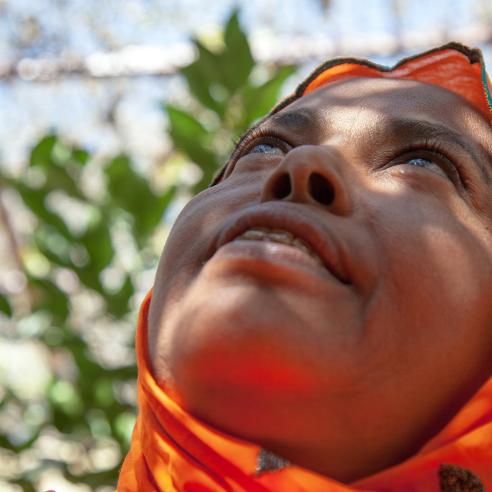
Ghana's seaside capital Accra is renowned for its thriving art scene, bustling markets, and booming tech sector, and is widely regarded as one of modern Africa's great success stories. However, like many fast-growing cities around the world, the effects of air pollution are of increasing concern and one of the leading causes of premature death.

Asilevi's wider research, from solar radiation modelling to rainwater sampling for aerosol chemistry, feeds directly into his air quality work. At the time of this interview, he was visiting EUMETSAT headquarters and the German Meteorological Service (DWD), working with EUMETSAT's Satellite Application Facility on Climate Monitoring (CM SAF) to validate radiation products over West Africa and exploring how weather prediction models could support regional air quality forecasting.
Asilevi’s work also compares ground-based air quality measurements with satellite observations, making use of data services provided by the Copernicus Atmosphere Monitoring Service, which is implemented by the European Centre for Medium-Range Weather Forecasts on behalf of the European Commission.
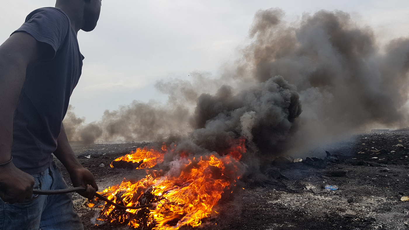
Agbogbloshie, Ghana, Wikimedia Commons, CC BY 4.0
New windows on air pollution flows
New generations of EUMETSAT’s meteorological satellite programmes and European Union Copernicus missions capable of detecting trace gases, aerosols, and particulate matter in unprecedented detail are changing this. Asilevi's work has included the modelling and development of nitrogen dioxide maps using the Copernicus Sentinel-5 Precursor (Sentinel-5P) mission.
This mission has shown what becomes possible when satellite observations are combined with high-resolution imagery and geospatial tools to reveal pollution patterns invisible to ground networks. Once operational, Asilevi expects data from the Copernicus Sentinel-5 instrument on board EUMETSAT's recently launched Metop Second Generation A1 satellite – which will deliver daily global observations of ozone, nitrogen dioxide, methane, carbon monoxide and other gases – to take that work to the next level.
"One of the key pollutants we are focused on is nitrogen dioxide, a gas produced wherever fuel is burned, from vehicle engines and industrial plants to the open fires that sweep across the region each dry season," he explains. "Exposure to nitrogen dioxide has been linked to cardiovascular disease and premature death, and where nitrogen dioxide is emitted, so too are other combustion pollutants that drive climate change. It is critical we get a better understanding of patterns and flows of nitrogen dioxide, and that is where satellite data come in.
“One of the tools we are using is the TROPOspheric Monitoring Instrument (TROPOMI) on board Copernicus Sentinel-5P. By combining the instrument's observations of nitrogen dioxide concentrations with high-resolution satellite imagery and geospatial analysis tools, we have been able to detail how nitrogen dioxide is distributed across West Africa for the first time. For example, this has enabled us to visualise persistent pollution concentrated around urban and industrial zones, as well as to detail clear seasonal patterns, with nitrogen dioxide peaking sharply during the region’s dry season."
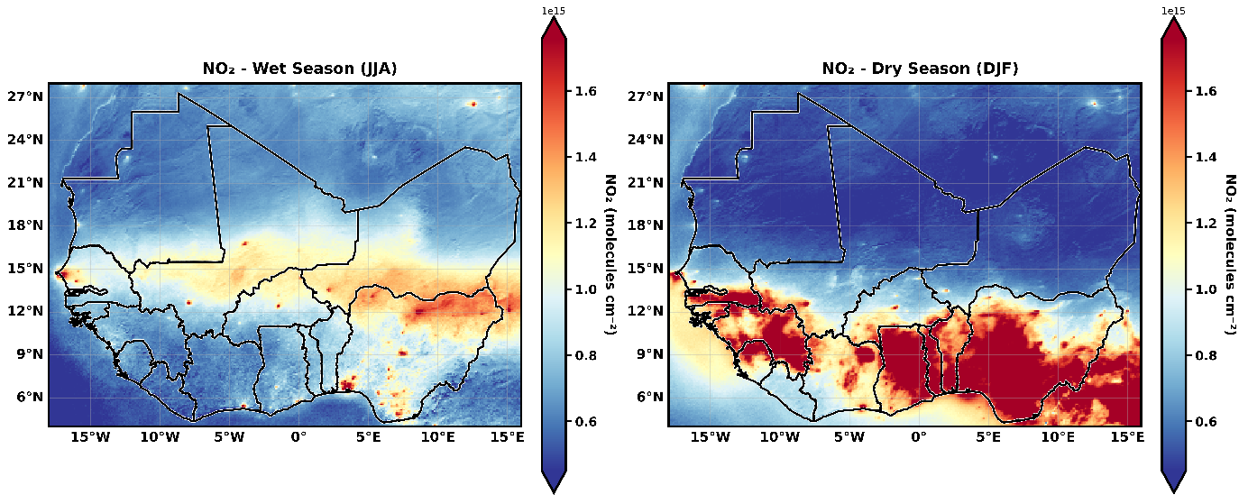
Credit: Image courtesy of Prince Junior Asilevi
Asilevi is now investigating where those peaks come from, comparing nitrogen dioxide observations with other satellite-derived datasets including fire radiative power products to explore the role of biomass burning.
"The connection between fires and nitrogen dioxide pollution appears to be very strong, with higher quantities mapping directly onto the fire patterns," he says. "We want to take this further and build tools that allow environmental protection agencies to monitor these sources routinely and target action where it is needed most."
Asilevi is also exploring ways to advance the development of population-weighted air pollution exposure indices, combining satellite pollution data with demographic information to pinpoint when and where the most vulnerable communities are at greatest risk.
"These indices will be very useful for health ministries when issuing advice aimed at protecting sensitive people such as children, pregnant women, elderly citizens, and those with respiratory conditions," he says.
Putting data to work
Next-generation satellite systems such as Meteosat Third Generation and EUMETSAT Polar System – Second Generation carry an array of new instruments and Copernicus missions that will expand these capabilities significantly, supported by specialist facilities such as EUMETSAT's Atmospheric Composition Monitoring Satellite Application Facility (AC SAF), which generates validated trace gas and aerosol products for air quality monitoring.
That means the satellite data available to researchers like Asilevi are expanding rapidly – and another challenge lies in specialists across Africa making the best use of them.
One important approach is through a longstanding cooperation with the African Union Commission, including programmes such as the Global Monitoring for Environment and Security (GMES) and Africa initiatives. The Cotonou Declaration, signed at the 2024 EUMETSAT User Forum in Africa, takes this further still, with signatories including the Economic Community of West African States (ECOWAS) Commission committed to strengthening satellite-based monitoring of greenhouse gases and air quality across the continent.
"Our work feeds directly into what the declaration is aiming to achieve," Asilevi says.
"We want to develop forecast tools and environmental monitoring dashboards that environmental protection agencies can use routinely to monitor pollution around industrial hotspots, rather than relying on mobile monitors. Data from Copernicus Sentinel-5 and other EUMETSAT-operated missions will present further opportunities to develop forecast models that can improve early warning systems."
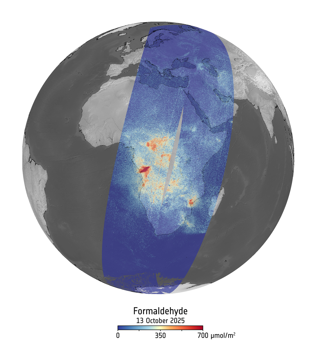
Credit: Contains modified Copernicus Sentinel data (2025), processed by ESA/S&T/TriOpSys/BIRA
These satellite data have the potential to transform how air quality is managed across Africa – but realising that potential depends on developing the products, tools, and expertise to put the data to work. Asilevi's own path, from teaching high school physics to working at Ghana's meteorological agency, gives him a sharp sense of what is needed – and it is why he is so passionate about encouraging young scientists to enter the field.
"In many respects, atmospheric science is an emerging field in West Africa, and it presents huge opportunities for young people. By taking a career in atmospheric science, you make yourself a global citizen who can become relevant across the world. The use of satellite products in West Africa can be enhanced if we can expand remote sensing training for master’s and PhD students and other professionals – and I want to encourage my students to pursue careers in these areas."
But for Asilevi, the data are only useful if they lead to action.
"Air pollution is a silent killer. We have lacked the data to tell the scientific story, to move the political will. Satellite data are giving us that opportunity – and they will save lives."
Author:
Adam Gristwood