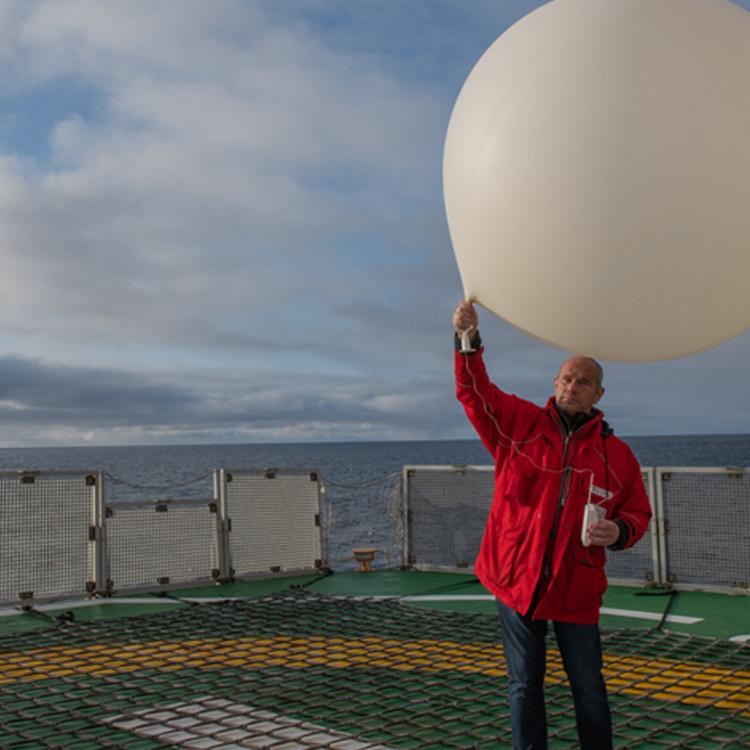
The wind watchman
Bringing data together for better wind observations and weather forecasts.


17 May 2022
28 April 2020

As my job title suggests, I do two different things for the European Severe Storms Laboratory (ESSL): one is to perform research. Either we work on research projects, or we perform so-called “research to operations” work where we evaluate how well products will help forecasters issue severe thunderstorm warnings.
I am also working as a trainer. Every year, we organise a number of courses for forecasters who visit us from all over Europe to learn how to forecast severe thunderstorms. Sometimes our courses take place in Wiener Neustadt (Austria) and occasionally we travel to other locations if we are invited to provide a course.
I have been with the ESSL since 2014.
I have always been interested in thunderstorms and used to love watching lightning. From a young age, I would stand at the window whenever there was a storm so that I could watch it for hours. When I was seven years old, I experienced a powerful thunderstorm in my hometown of Poprad, Slovakia. It left me with very vivid memories of my parents trying to close the windows that had flung open by strong wind gusts. There was even hail falling into our apartment. Quite a bit of damage occurred outside as a result of that storm, so this left a very strong impression on me and ever since I was just hooked on storms.

I was always trying to find literature on this topic and visiting libraries to borrow books and of course, when the internet became available, this was one of the first things I searched for. When I started at university, I joined a group called “ESTOFEX” (the European Severe Thunderstorm Forecasting Experiment), which is a small online platform for enthusiasts who want to discuss and forecast severe thunderstorms and involves making pan-European severe thunderstorm forecasts.
While living in the Czech Republic I would forecast storms over Spain, Italy, the UK and Greece, and this contributed a lot to my experience as a forecaster. I am still making these forecasts, by the way. I then went on to study for my Master’s degree in physical geography and after graduating, I started working as an operational weather forecaster; first in the Czech Republic and then in Slovakia. Finally, I joined ESSL as a researcher while pursuing a PhD.
This is always a very arbitrary choice, so what one person might consider “severe”, another would only call “marginal”. It also depends on where you are, because if you are walking in the mountains, even one flash of lightning can be extremely dangerous. If you are sitting inside your warm, cosy house, it is not so threatening. Because we collect severe weather reports at ESSL, we needed to come up with definitions within ESSL. We have now determined that a severe thunderstorm must meet at least one of the following criteria:
- The storm produces some wind-gust damage (if the wind exceeds 90 km per hour)
- There are hailstones larger than 2cm in diameter
- There is a tornado present
- The storm produces flash flooding

We also collect data on other weather phenomena across Europe such as, for example, heavy snowfall or avalanches, but our training courses and research are strongly tied to thunderstorms.
Immediately, I would say northern Italy. This is confirmed by climatologies based on remote sensing data over many years, as well as climate models and reanalyses. Northern Italy is THE severe thunderstorm region in Europe.
Forecasters will always look at satellite imagery when they are testing a new product using our data platform or during courses. They do this to see how powerful the storms are, or to detect where new storms are beginning to develop for the purposes of very short-term weather forecasts. Recently, we have also been working with data that is more indirectly derived from satellites and can tell forecasters more about the environment in which storms are forming.
The satellite measures radiances from different levels of the troposphere and, based on a huge amount of data from hundreds of channels, we can reconstruct the vertical profiles of temperature and humidity. From those, we can calculate how much energy will be released within the storm and this is something we have been working on this year at our testing facility which we call the “ESSL Testbed”. We run it annually in June and July, usually for a period of four weeks.
It’s both: we concentrate on how to anticipate whether storms will be severe or not, even before they start forming, and on detecting if a particular storm is severe and requires immediate attention. For both, forecasters can use EUMETSAT data.
We don’t collect data about financial losses. This is usually collected by insurance and reinsurance companies. We do receive some figures because of our cooperation with Munich Re. They are a very large reinsurance company and thanks to them we were able to work with their database containing these thunderstorm-related losses.
At ESSL we operate the co-called European Severe Weather Database, in which we collect reports of severe weather. For example, if a thunderstorm happens somewhere in-between weather stations and somebody takes a picture of a big hailstone in their hand, this is something we are interested in. We store this information in our database including the location, time, hail size estimate and sometimes a qualitative description of the type of damage.
The database is an import resource that can be used to verify forecasting techniques. They are also used to calibrate forecast products derived from satellite data.

I think that since 2014 we have started to concentrate more on educating forecasters. This means that I give more courses now compared to the past, but I still try to do research work as well.
The weather community has high expectations of the new MTG satellites and the products derived from the new sensors. There will be new datasets that forecasters are looking forward to. For me, personally, the most interesting product will be the Infrared Sounder (IRS). We will be able to get vertical profiles of temperature and humidity every 30 minutes across the whole of Europe and I think this is going to be a game changer not only for the forecasters in operations, but also for the weather modelling community.
For us at ESSL it was exciting to already work with similar data from polar-orbiting satellites and see how forecasters would use it in practice. The Lightning Imager (LI) will also be very useful, especially in regions where there is poor or no radar coverage. We think the lightning imaging data will be able to improve the quality of severe weather warnings. In addition, the higher spatial and temporal resolution of the Flexible Combined Imager (FCI) will help forecasters to better identify the moment when storms are becoming severe or when they are beginning to form. Finally, I think that data fusion will become very important, where the best that satellite sensors have to offer can be combined with radar and numerical weather prediction data.
I have to say I enjoy my work a lot. I really enjoy interacting with forecasters from all over Europe at the Testbed or at the training's - this is something that I am always looking forward to.
One of the challenges we currently face is that from some regions we receive many severe weather reports into the database and have a very good cooperation with voluntary observatory networks where people are dedicated to reporting to our database. However, in other regions we get fewer reports and ESSL staff will do most of the reporting. Our database manager has had to learn severe weather terminology in many different languages as a result.
We do not have that much direct interaction with the general public. At ESSL we interact more with meteorological services or directly with the meteorologists that attend our training events and workshops. Of course, we interact with researchers who are using this severe weather database for their work. They ask us about the quality and reliability of the database across particular regions. They are usually happy with the unique severe weather data set that we can provide to improve their algorithms, forecast products or risk analyses. But, of course, there is always room for improvement. It would be great to find more volunteers who are able to report severe weather in their neighbourhood to our database.
Of course, one should study a topic related to atmospheric science, but what is more important is a strong interest in the subject and to be passionate about it. The best meteorologists, researchers or forecasters that I have met have always displayed very strong enthusiasm about the topic.
Thanks very much to Tomáš for this informative chat! As he mentioned, if you’re interested in reporting severe weather in your area then take a look at the database here.
If you’re interested in finding out more about EUMETSAT’s next generation of satellites, please visit our website where we provide information on the different satellites, their instruments and the benefits of each mission.