Air pollution is Europe's greatest environmental health threat, and despite progress in recent decades to reduce its burden, it was still attributed to hundreds of thousands of premature deaths in 2022. The European Union's Copernicus Sentinel-4 mission, operating on board EUMETSAT's Meteosat Third Generation Sounder 1 (MTG-S1) satellite, has begun delivering its first preliminary images from space, marking a major milestone in Europe's air quality monitoring capacity. The mission's hourly data streams will support authorities in delivering timely air quality forecasts and health warnings to help save lives, improve quality of life, and reduce associated environmental costs and economic damage across the continent.
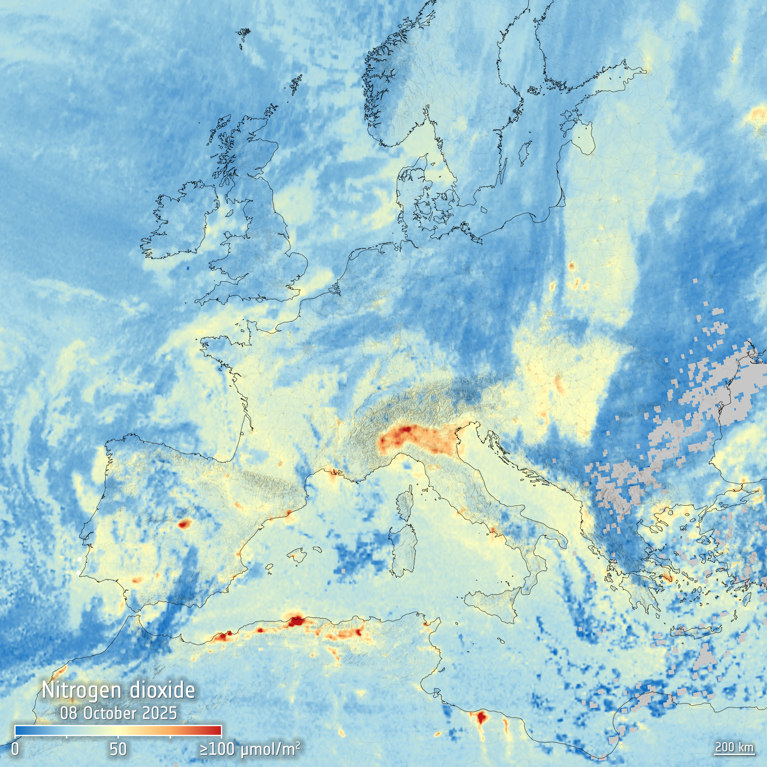
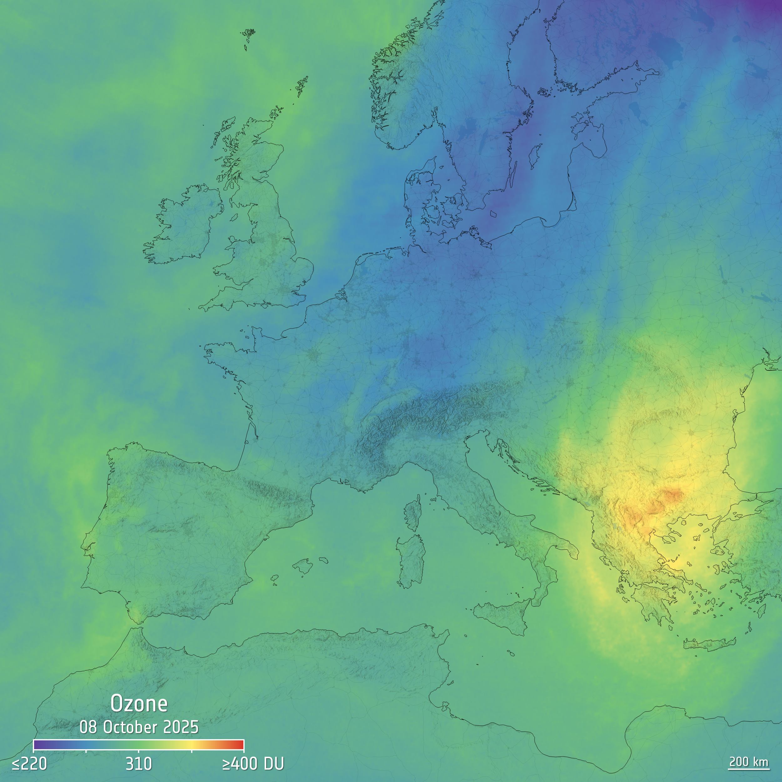
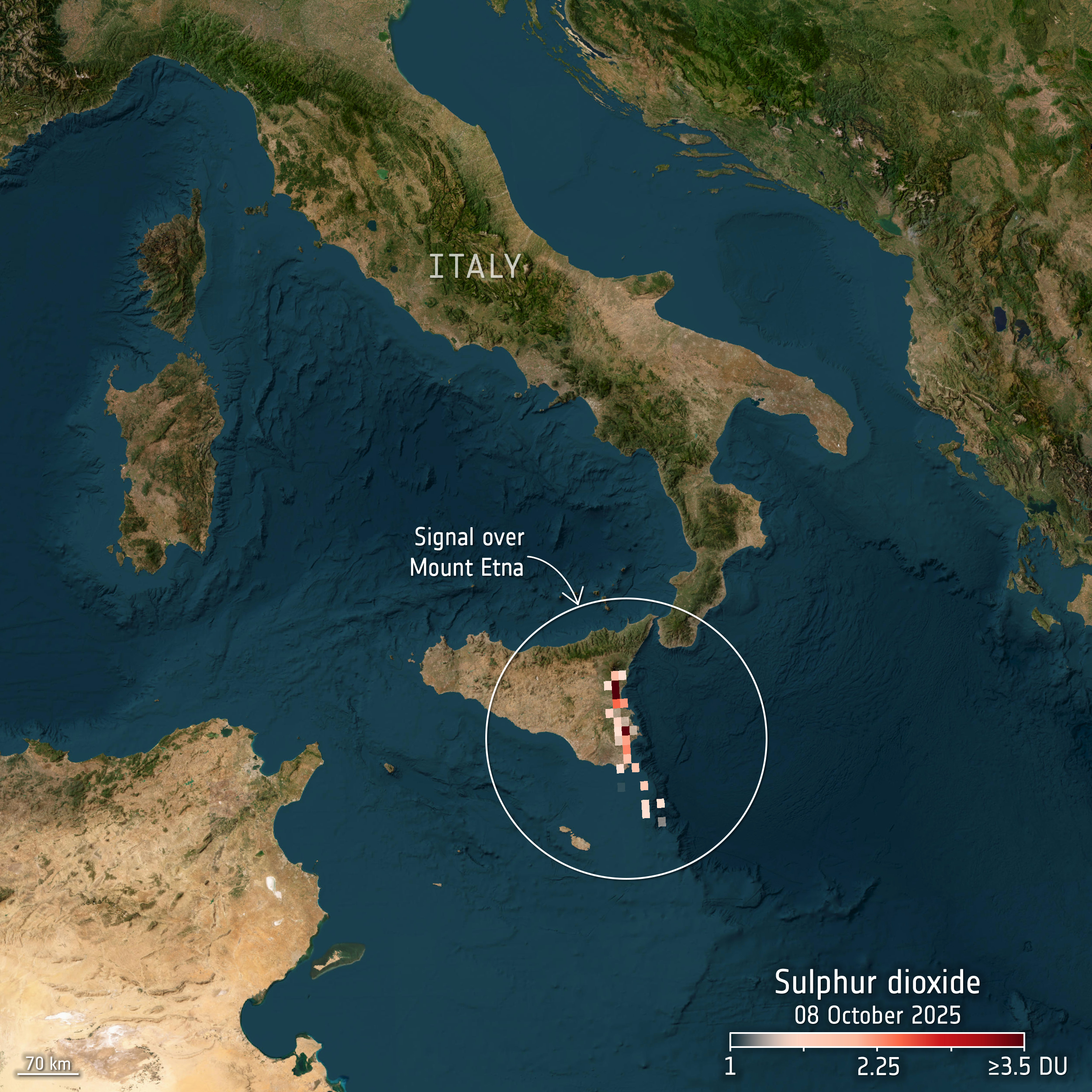
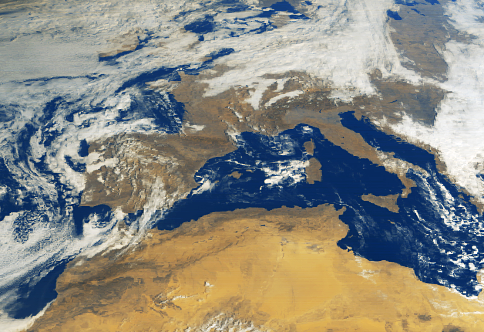
The first images, captured on 8 October 2025 and released to the world today, demonstrate Copernicus Sentinel-4's remarkable capability to track multiple pollutants and trace gases across Europe and surrounding regions. The images reveal nitrogen dioxide hotspots over Italy's Po Valley, elevated ozone levels across the Balkans, Bulgaria, and Greece and sulphur dioxide plumes from both natural and anthropogenic sources.
Copernicus Sentinel-4 is still undergoing commissioning so these early first images represent just a taster of what is to come: once operational, the mission will provide unprecedented hourly views of such pollutants across Europe from geostationary orbit. The hourly capability will enable experts to track how pollution varies throughout the day – such as traffic peaks during rush hour – and observe pollutants like ozone as they form, revealing differences between city centres and suburbs and providing authorities with more precise information to protect public health.
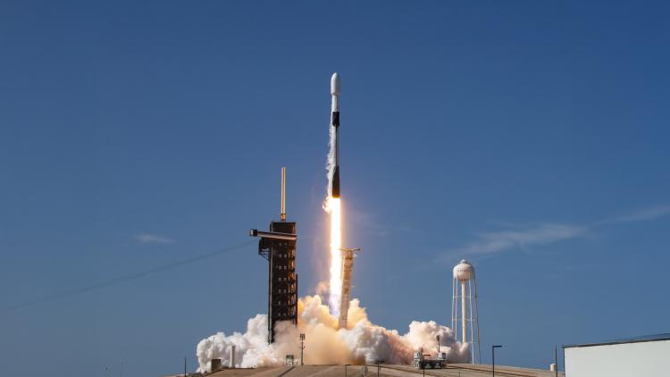
Following MTG-S1's successful launch on 1 July, Copernicus Sentinel-4 is now in its commissioning phase, where teams are testing and fine-tuning systems to ensure optimal performance. While these first images show the mission is already working well, the commissioning process ensures that the underpinning data meets the rigorous accuracy and reliability standards essential for operational use. Once commissioning is complete, these critical data streams will enhance existing atmospheric monitoring capabilities with unprecedented hourly coverage of atmosphere over Europe and surrounding regions from space.
Phil Evans, Director-General of EUMETSAT, said: “Exposure to pollutants such as nitrogen dioxide, ground-level ozone, and fine particulate matter affects millions of Europeans every day, costing society hundreds of billions of euros annually. Copernicus Sentinel-4 represents a fundamental advance in our ability to monitor these pollutants. These first images demonstrate the mission's transformative potential to save lives and improve health outcomes by feeding into better air quality and climate monitoring across Europe. EUMETSAT is proud to host the Sentinel-4 instrument aboard our MTG-S satellite and to be part of this landmark European collaboration. We now look forward to operating the mission throughout its lifetime, ensuring a continuous flow of critical data to ensure maximum impact.”
Lieven Bydekerke, EUMETSAT Copernicus Programme Manager, said: “These first data provide an exciting early glimpse of Copernicus Sentinel-4's ability to capture rapid changes in air pollution across an entire continent – tracking how pollutants that are a major cause of respiratory and cardiovascular disease move and evolve throughout the day. Hourly observations of these hazardous pollutants over the whole of Europe have never been possible before. As we work to make the mission’s data operational as quickly as possible, these incredible first observations demonstrate the power of European collaboration and value of hosting multiple instruments on a single platform.”
Developed under the Copernicus programme, the Earth observation component of the European Union Space Programme, the mission is implemented through a partnership between the European Commission, the European Space Agency (ESA), and EUMETSAT. EUMETSAT operates the MTG-S1 satellite platform and is responsible for processing and disseminating the data to users worldwide. Sentinel-4 will greatly improve Europe’s air quality forecasts through the Copernicus Atmosphere Monitoring Service (CAMS), which is operated by the European Centre for Medium-Range Weather Forecasts (ECMWF).