Preparing for Meteosat Third Generation: Think global, act local
How experts in Central and Eastern Europe are preparing for Meteosat Third Generation
How innovations in science and technology have driven Meteosat programmes to new heights
Their ingenious solution involved expanding an experimental data dissemination method called EUMETCast, an approach that encodes data in standard digital video broadcast (DVB) signals and delivers them to receiving stations using commercial telecommunication satellites, much like a satellite television broadcast.
EUMETCast was not only a successful workaround, it also opened up opportunities to make EUMETSAT and third party data accessible to any approved user with a suitable reception device and a personal computer. It was an example of the proverb ‘ìn a crisis there is usually an opportunity’. And this opportunity was well seized by EUMETSAT engineers.
EUMETCast is now EUMETSAT’s primary data dissemination mechanism, enabling users across Europe, Africa, and the Middle East to access data crucial to responding to natural disasters, predicting thunderstorms, and understanding climate change.
Such innovations have been part and parcel of the success of Meteosat since the first satellite was launched in 1977, says Dr Johannes Schmetz, former EUMETSAT Chief Scientist and Head of the Meteorological Division.

“When the first geostationary meteorological satellite of the USA was launched in the mid-1960s, it enabled the continuous imaging of almost an entire hemisphere for the first time,” says Schmetz, who has worked both on EUMETSAT’s scientific programmes and in guiding the development of its satellite systems and applications.
“By placing satellites in an orbit that keeps pace with the Earth’s rotation from a height of roughly 36,000km above the equator, meteorologists could watch weather and storm systems develop and evolve.
“Rather than relying on a set of images disjointed in time, fast-moving weather events were captured in time-series pictures that could be pieced together in movies. It proved revolutionary for Earth observation. This, in fact, had been the plan of Professor Verner Suomi of the Space Science and Engineering Center in Madison, Wisconsin, USA, who invented geostationary meteorological satellites.
“Nevertheless, it’s important to remember that during early programmes there were substantial limitations in terms of aspects such as storage capacity, image resolution, and calibration.
“Therefore, scientists had to be very creative to maximise the potential of the data.”
Meteosat’s first generation programme set the eyes of geostationary meteorological satellites on Europe for the first time, providing valuable data on atmospheric circulation and weather every 30 minutes.
The main focus of the programme was on obtaining images of fast-evolving weather events and the movement of large-scale systems, however the satellites also included a “thoughtful late addition” initiated by Professor Pierre Morel: a new radiometer channel capable of measuring emissions from water vapour.
It was the first of its kind to be used in geostationary orbit.

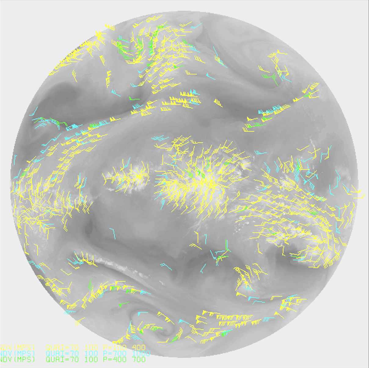
“Wind transfers heat and moisture around the world, and it plays a key role in how weather evolves at different scales but it was not possible to infer winds at a global scale,” says Schmetz. “The advent of geostationary satellites helped improve the situation.
“Good estimates of winds can be made using satellite image sequences, for instance by tracking clouds or water vapour features.
“The potential to derive wind speed and altitude as well as other attributes of the troposphere, such as cloud properties and water vapour, was firmly on the minds of those who led the early development of geostationary meteorological satellites, notably Professor Suomi.
“Not all the good potential of Meteosat First Generation was realised in the early phase of the operational programme. For instance, it was not until about a decade after Meteosat-1 was launched that an automatic operational method to derive water vapour wind fields was developed for the Meteosat water vapour channel images.”
Schmetz explains that the realisation was inspired by research carried out by experts at the Space Science and Engineering Center in Madison, who derived the wind information manually.
“The new water vapour data provided fresh insights into the dynamics in the mid- and upper troposphere and the movement of weather systems, delivering invaluable contributions to weather forecasters.
“This spirit of sharing scientific ideas between different researchers, institutes, and countries made satellite data much more effective and efficient. It was and is a key reason why satellite meteorology rapidly developed such an important role in weather forecasting and protecting lives and property.”

The advent of the Meteosat Second Generation (MSG) programme increased the number of data channels from three to 12, offering vastly better timeliness, resolution, and calibration.
“MSG provided meteorologists and other data users with a continuity of services from the previous programme as well as immense opportunities to improve and do new things,” Schmetz says.
“This facilitated the development of products that allow users to better observe and predict wind, clouds, storms, fires, droughts, floods, and much more.
“Nevertheless, this huge upgrade presented challenges that required a lot of smart thinking and the hard work of many people, including engineers, scientists, and users, in order to maximise the potential use of the data.”
Some of these challenges were anticipated from the start, Schmetz says, while others arose unexpectedly.
“Atmospheric motion products, taking advantage of the vast improvements in the number and resolution of images provided, helped improving weather forecasting and nowcasting substantially and continuously,” he explains.
“An interesting and very important fact is that the largest positive impact of new data emerges once we have learned how to best use the data. Of course, having the new data in the first place is a prerequisite.
“Another example comes from a better and consistent reprocessing of past satellite data and products, – especially valuable for use in reanalyses and for studying climate variability and change.
“Experts, notably at EUMETSAT, are hugely successful in recalibrating and reprocessing data from past satellite missions and integrating them into the models used for today’s reanalyses.”

And then there are many unexpected ways that MSG data have been applied: from monitoring unusual hurricane formation processes, to establishing more effective ways of deciphering cloud properties, to monitoring the impacts of volcanic eruptions, such as from the Eyjafjallajökull volcano in Spring 2010.
The latter coincided with north-westerly winds and a prolonged period of stable weather over Europe and caused havoc for air travel across much of Europe.
“During the Eyjafjallajökull eruptions, products using data provided by MSG’s multichannel instruments enabled meteorologists to monitor and better understand the flows of ash particles in the atmosphere,” Schmetz explains.
“Furthermore, MSG data helped experts to better understand the complex processes in the atmosphere following volcanic eruptions and the atmospheric transport of volcanic ash.

“This has enabled meteorologists to improve forecasting volcanic ash distributions, not only showing where ash clouds are headed, but also giving better indications of when and where peak concentrations might occur, crucial in deciding whether or not it is safe for a plane to take to the skies.
“Our continuously improved ability to make use of MSG is based on scientific understanding and advances – and vice versa – operational requirements trigger efforts to improve our scientific understanding.”
One particularly effective way of driving this dynamic is EUMETSAT’s Satellite Application Facilities (SAFs), which were established in the mid-1990s with the aim to directly involve EUMETSAT member states and their expertise in the operational derivation of products and services from the organisation’s satellite data – a novel idea put forward by John Morgan, the first Director-General of EUMETSAT, Schmetz adds.
“MSG presented a multitude of opportunities for the SAFs to come into their own, providing a platform to drive innovation in the use of satellite data in specific areas including atmospheric composition monitoring, climate monitoring, land surface analysis, ocean and sea ice, numerical weather prediction, radio occultation meteorology, nowcasting, and operational hydrology and water management,” he says.
“EUMETSAT’s SAFs are a well-structured way of fostering the development of advanced products and services by expert groups and provide an important example of how to develop the use of satellite data to its full potential. One can say that EUMETSAT SAFs are seen world-wide as an exemplary process to develop satellite products and services.
“It’s also important to add that initiatives such as the Committee on Earth Observation Satellites (CEOS) and the Coordination Group for Meteorological Satellites (CGMS) have been instrumental in sharing satellite data and exchanging ideas in a coherent manner at the international level.
“Meteosat Second Generation – which will run until 2033 – has been a hugely successful programme. That is down to the hard work of engineers from European industry, EUMETSAT and ESA, with tremendous contributions from international teams.
“The well-orchestrated work at EUMETSAT leads to high user satisfaction, and continuous development of data use toward exploiting its full potential. Or to quote many delegates from our member states: It is value for money!”
Schmetz points out that the development of Meteosat’s next great endeavour – the Meteosat Third Generation programme – has benefitted from extensive user consultation, planning, and input from experts. This user consultation process devised by Dr Alain Ratier, a former Director-General of EUMETSAT, has been a key factor for a good convergence on requirements satisfying user needs.

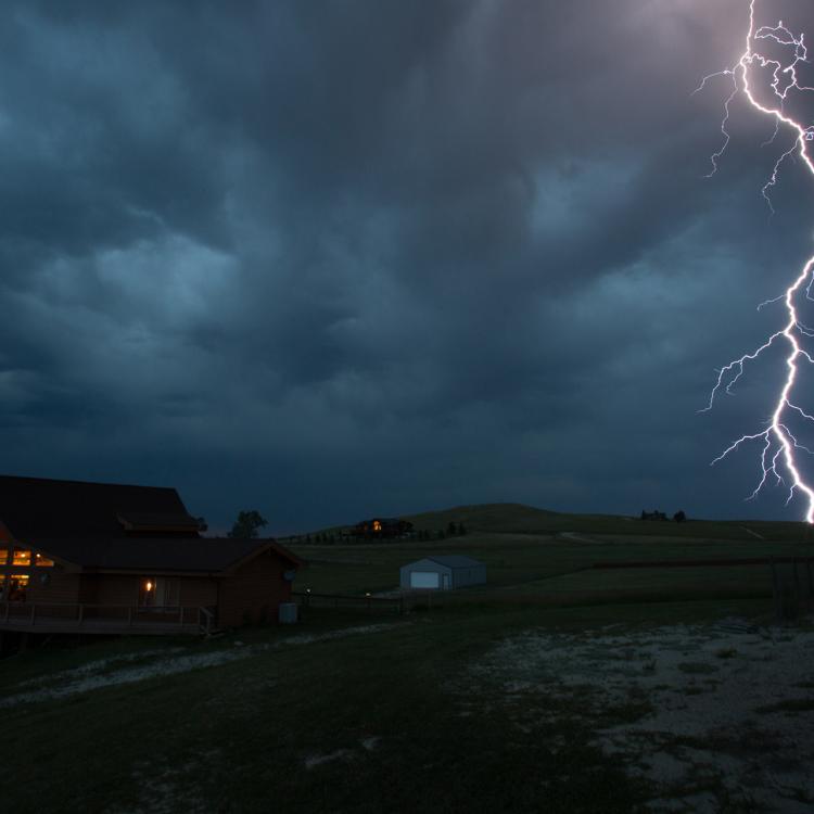
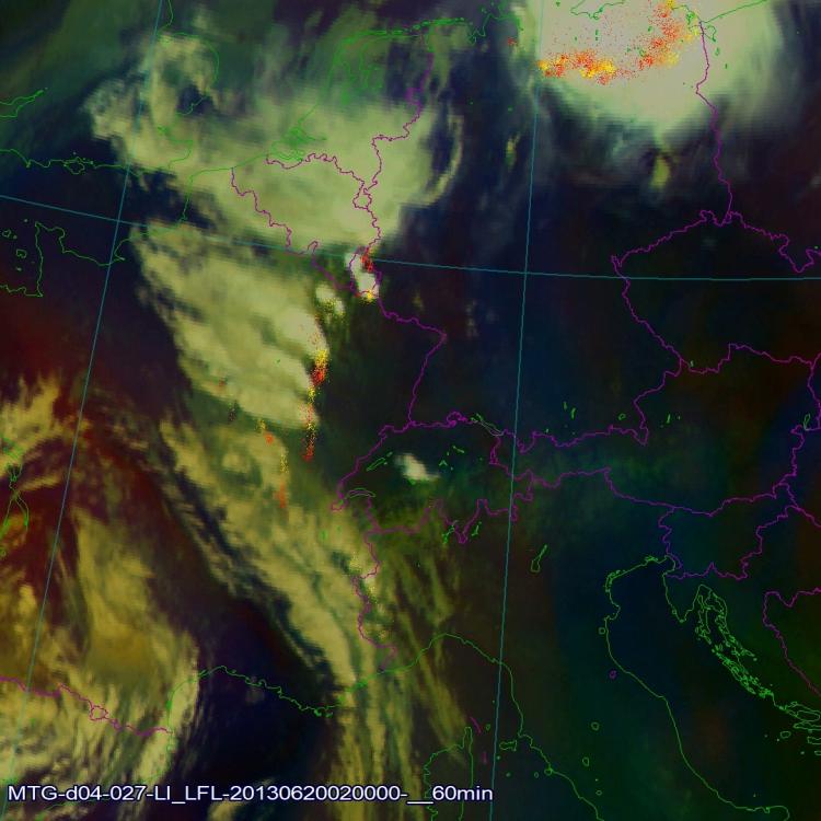
“MTG presents another step change in improvements in spatial, temporal and radiometric resolution, and also provides entirely new types of satellite data over Europe, such as lightning data from the programme’s Lightning Imager,” he says.
“The programme’s sounding mission, on the other hand, will enable observations of convection much earlier than previous Meteosat missions.
“MTG will enable the seamless continuation of services that have been developed using MSG data.
“And there is massive potential to develop better applications for nowcasting, numerical weather prediction, hazard monitoring, atmospheric composition, storm tracking, wildfire detection, and much more.
“Just one example – and there are countless others – is the potential to detect, with the InfraRed Sounder, very early signs of convective activity in areas that are cloud free by observing telltale changes in humidity that could lead to severe storms.
“Getting products to a level where this is possible will take time and enormous skill on the part of researchers – however, we can be confident that the experts at EUMETSET and in its member states will continue to meet the challenges.
“MTG will also present a multitude of opportunities for new applications that we haven’t even dreamed of yet.
“In this sense the exciting launch of MTG’s first imager satellite is as much a beginning as an end: a satellite launch and deployment in the operational orbit is a milestone and at the same time it is the beginning of a journey to seek and raise the treasures, which are hidden in the new data.”
Adam Gristwood