Eyes on the ocean
A powerful collaboration supports ocean monitoring and forecasting

Dr Pierre-Yves Le Traon of Mercator Ocean International explains how the European Union’s Copernicus Marine Service uses data from EUMETSAT-operated satellites to support the ocean sector.
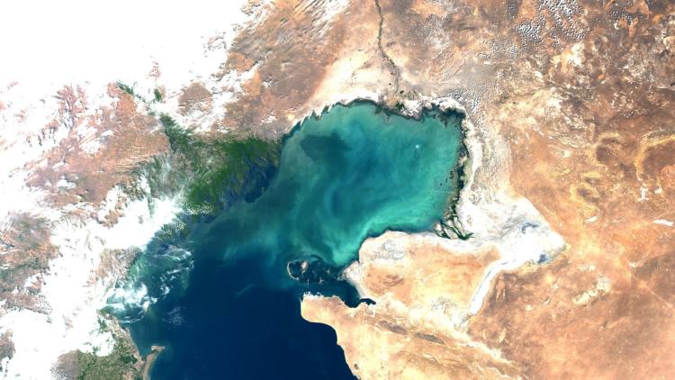
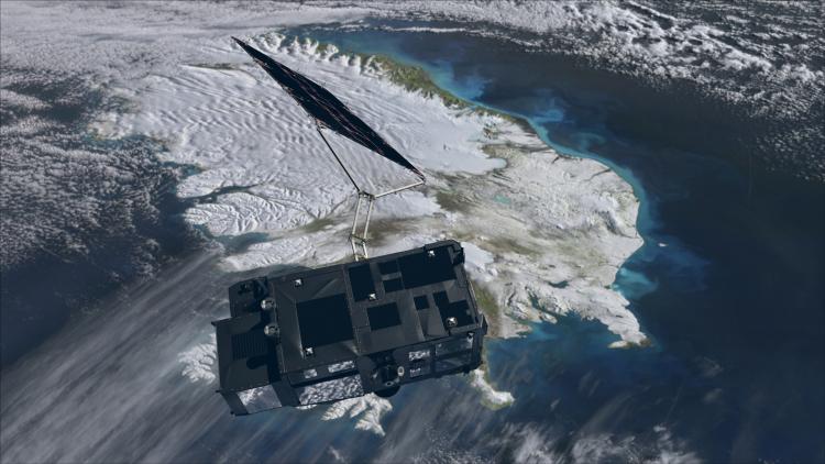
Sentinel-3 Ocean and Land Colour Instrument
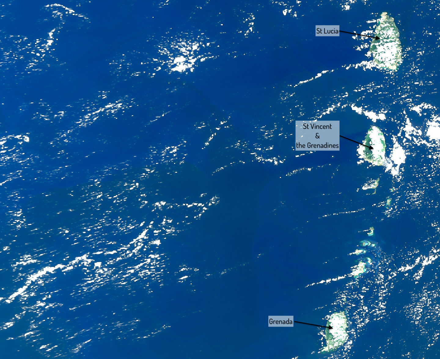
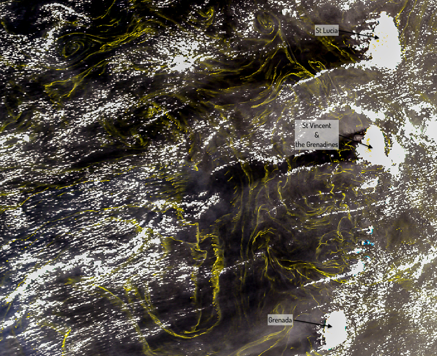
These images from the Copernicus Sentinel-3 Ocean and Land Colour Instrument of the southern Caribbean on 14 May 2025 show the accumulation of sargassum. In the image on the left, the ocean colour can be seen the way it would be perceived by the human eye; in the image on the right, the colours have been altered to show the sargassum more prominently.
They have done this by providing open access to satellite observations including those from the Ocean and Land Colour Instrument on board EUMETSAT-operated Copernicus Sentinel-3 satellites. Since November 2025, the Copernicus Marine portfolio also includes a Floating Algae Indicator (FAI) product derived from Copernicus Sentinel-3, Copernicus Sentinel-2 and other satellites, which makes it possible to monitor floating sargassum in near-real time.
This is just one important way the Copernicus Marine Service serves its more than 110,000 registered users, who include people in maritime transport, marine biodiversity protection, fisheries management, climate change monitoring, and more.
“Our data support all sectors of the blue economy. They also help predict extreme events such as coastal flooding, enabling early warnings and disaster risk reduction. In addition, we deliver critical indicators that guide climate mitigation and adaptation strategies,” said Dr Pierre-Yves Le Traon of Mercator Ocean International where he is Scientific Director and oversees the management of the Copernicus Marine Service.
“We monitor and forecast the blue ocean, relating to ocean physics, the white ocean, which has to do with sea ice, and the green ocean, relating to biogeochemistry. Regarding the blue ocean, we observe physical properties from the surface to the depths, including currents, temperature and salinity. Relating to the white ocean, we forecast many parameters of sea ice such as concentration and ice drift. And in regard to the green ocean, ocean colour observations from satellite instruments play an important role. They enable us to monitor water quality, ocean health, and primary production, the process through which plants and bacteria turn inorganic matter into organic matter, which is crucial for the marine food chain.”
These forecasts incorporate measurements from a range of sources, including instruments in the sea, such as robotic profiling floats, and satellite instruments. In addition to using observations from the Ocean and Land Colour Instrument, the Copernicus Marine Service also uses observations from the Sea and Land Surface Temperature Radiometer on board the same satellite, as well as sea level observations from both Copernicus Sentinel-3 and Copernicus Sentinel-6 altimeters.
“We rely a lot on the Copernicus Sentinel satellites, in particular Sentinel-3 and Sentinel-6, which play a major role in the services that we provide,” said Le Traon.
“For the global ocean, Copernicus Marine uses a physical model of the ocean and sea ice, which has a resolution of a few kilometres. And then we have specific models at higher resolution for European regional seas. In these models, we assimilate different satellite observations, such as sea level, sea surface temperature, ocean colour and sea ice, together with in-situ observations. These are used to provide a description of the present state of the ocean as well as a forecast for the next ten days.
“All these satellite observations are crucial for our monitoring and forecasting activities. Sea level measurements from satellite altimetry, particularly from Sentinel-3 and Sentinel-6 satellites, play a prominent role in constraining our models.”
Le Traon is passionate about continuing to improve how the Copernicus Marine Service supports the ocean sector.
“We are currently preparing the next generation of our ocean and sea ice monitoring and forecasting systems that will benefit from the future Sentinel missions and fully harness the potential of artificial intelligence. Our motivation to further develop these capabilities is not only to benefit people working at sea, but also to support the development of policies to protect the ocean and planet, which benefits everyone.”
Author:
Sarah Puschmann