
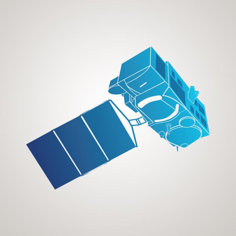
Copernicus Sentinel-3
Dedicated Copernicus satellite mission delivering a variety of high-quality ocean measurements.

EUMETSAT’s Hilary Wilson reflects on the immense team effort behind the Copernicus Sentinel-3 mission

13 February 2024
25 April 2023
On a typical day in the Copernicus Sentinel-3 control room at EUMETSAT’s headquarters in Darmstadt, Germany, the quiet murmur of conversation amongst the operations and monitoring teams might seem a world away from the chaos and excitement of control centres depicted in Hollywood blockbusters.
And that is exactly how Hilary Wilson, EUMETSAT’s Sentinel-3 mission manager, likes it.
“Instruments on board Sentinel-3 satellites provide a multitude of optical and microwave observations primarily focused on monitoring the behaviour and health of the ocean, but also of the Earth’s atmosphere, land and ice surfaces,” says Wilson, who joined the Sentinel-3 project in 2008, before taking on the role of project manager in 2015 and adding the role of mission manager in 2016.
“The big picture provided by the constellation of twin satellites supports a diverse range of applications such as ocean forecasting, sea surface temperature monitoring, marine pollution monitoring, crop performance assessments, ice surface measurements, ship routing, wildfire detection, disaster response, and climate science.
“The instruments on board the Sentinel-3 satellites systematically and continuously monitor the Earth, delivering raw mission data to the ground approximately every 100 minutes.
“EUMETSAT processes the data and disseminates the associated products, the fastest of which are the near-real-time products provided within three hours of sensing. They are freely available to anyone in the world with a computer and internet connection – 24 hours a day, 365 days a year.

“Therefore, any issues arising with the operation of the satellites or their instruments need to be dealt with quickly and effectively so that those who use the data keep getting complete, high-quality Sentinel-3 data fast enough to meet their needs.
“The team must stay calm and in control at all times, whether that’s implementing a scheduled upgrade to our systems, investigating an unexpected fluctuation in the data, or carefully manoeuvring satellites out of the way of oncoming space debris.”

The Copernicus Programme is a component of the European Union’s space programme. It offers information services that draw from meteorological satellite observations and in-situ data, which help service providers, public authorities, and organisations improve quality of life and protect lives and livelihoods in Europe and beyond.
The European Commission manages Copernicus. It is implemented in partnership with EU Member States, EU Agencies, EUMETSAT, the European Space Agency (ESA), the European Centre for Medium-Range Weather Forecasts (ECMWF), and Mercator Océan International. The information services provided are openly accessible to all.
However, the unflappable nature of the 100-strong team working in areas such as system operations, flight control, data processing, dissemination, and archiving – with responsibilities shared between EUMETSAT and the European Space Agency – was tested to its limits when developing and launching the series’ first two satellites, Sentinel-3A and -3B.
“For EUMETSAT, Sentinel-3 meant many firsts,” Wilson says.
“It was the first Copernicus mission that EUMETSAT was involved in, the first mission where we jointly developed parts of the ground segment with ESA, and the first EUMETSAT-operated mission to involve a two-satellite constellation.
“When delivering such an immense project under tight time constraints, there will inevitably be a few tense occasions along the way.”
Wilson casts her mind back to just a handful of these critical junctures ahead of the launch of the mission’s first satellite, Sentinel-3A, on 16 February 2016.
There was the challenge of meeting the evolving needs of service providers during the development phase, one example being a choice quite late in the day to use the most detailed resolution of the mission’s altimeter instruments so that they could observe finer details of the topography of the sea surface.
Then there was the time when a train responsible for transporting the satellite to its launch site broke down, requiring a quickly-assembled team of people to physically push the train and the satellite to its destination, as detailed in the mission’s revealing launch blog.
Throughout, Wilson had maintained a determined focus on success. And it was only when she was set to give a speech at the spacecraft’s much anticipated launch event – hair and make-up done, cameras blinking – when she let herself think about what she might need to say if the launch or other critical launch and early orbit phase activities failed.
“I was sitting on stage at the European Space Operations Centre in Darmstadt: all of my focus had been on getting Sentinel-3A into orbit,” she recalls.
“Minutes ahead of the launch, I thought: OK what am I going to say if something goes wrong?
“Luckily, despite a couple of last-minute obstacles, the launch was a terrific success.
“In my role I have, for such formal events, to be front and centre, but actually where I really want to be in these moments is with my team, who were gathered at EUMETSAT’s headquarters, across the road.
“They are the ones who have actually done the job, overcome the challenges, and got the systems ready for launch, and made EUMETSAT and me look good!
“I was thrilled to be able to join up with them later that evening at the EUMETSAT event so we could celebrate together: Sentinel-3 is a huge team effort and it would be impossible without them.”

Another hurdle was the short timescale between launches, with Sentinel-3B following -3A some 26 months later, on 25 April 2018.
“After Sentinel-3A was launched, its solar panels and antennae were deployed, systems checked, and it entered a commissioning phase,” Wilson explains.
“The spacecraft’s instruments were activated and calibrated, its data transmission tested, instruments fine-tuned, and data flows started for users such the Copernicus services and the Sentinel-3 Validation Team.
“The focus at this point is on ensuring the best quality data and the best timeliness for the wide range of products and services making use of these datasets.
“There was a handover ceremony with EUMETSAT taking the responsibility for the flight operations from ESA upon the completion of the commissioning phase, where we transitioned to the operations phase and began providing operationally qualified data for users.

“It allowed for a brief period where I thought: phew, I can relax now, everything’s working fine.”
However, soon came the realisation that the launch of Sentinel-3B was coming just over the horizon.
“There was a huge programme of work still to do: we were beginning operations on one satellite, whilst preparing another for another launch,” Wilson recalls.
“We needed to provide support for scientific teams, run testing and validation activities, make system upgrades, quality-check products, address unexpected anomalies, and carry out the important standard programmatic reviews ahead of a ramp-up to full operational production.
“At the same time, we were preparing for something that we had never done before: a tandem phase that would allow us to compare the performance of the twin satellites when both were in orbit.”
In order to provide good coverage of the Earth’s surface, the Sentinel-3B and -3A satellites are usually phased in the same orbital plane but 140° (approximately 39 minutes) apart, this provides the best phasing for the altimetry ocean topography sampling with minimal impact on the optical mission.
However, upon launch, Sentinel-3B was initially guided into an orbit just 30 seconds apart from -3A. This enabled comparisons of the satellites’ instruments as they fly over the same part of the Earth’s surface at a similar time.
“Doing this added some complexity into the mix,” Wilson says. “However, there are a lot of benefits to running a tandem phase. In particular, it enabled us to carry out commissioning and validation activities more quickly, and thus to operationally qualify products faster than usual.
“There was a great amount of excitement at the time as we were doing something new for EUMETSAT – since then the organisation has operated tandem phases for other Copernicus missions such as Sentinel-6 and the Jason-3 satellite altimeter.”

Since the launches of Sentinel-3A and -3B, Wilson says there have been many highlights along the way, including receiving the first images from the instruments, and seeing the ongoing benefits of the satellite data for ocean, atmosphere and land monitoring – and supporting applications for water resource management, agriculture, and air quality monitoring.
Another has been the collaborations forged between partners.
“A great synergy has been developed through the Copernicus programme, where we share responsibilities and expertise with ESA, the European Commission, and a wide range of other partners,” Wilson says.
“Since all organisations have their own methods of working, in many respects we were treading new ground in our relationships particularly with ESA – we had to be flexible, learn and adapt to different ways of working.
“But at the same time, this has also presented opportunities to innovate – for example in how we give users access to data. Sentinel-3 was the first mission to have systematic “pull” dissemination systems like the ODA (Online Data Access) and CODA (Copernicus Online Data Access) mechanisms that have now been adopted EUMETSAT-wide in the new EUMETSAT Data Store.
“The reason we got there and were ready on time is because there was a huge set of very dedicated people, who went above and beyond, and made it look to the outside world that it was really simple, when it really wasn’t.”

For Wilson, managing the Sentinel-3 mission for EUMETSAT was a natural fit following a decades-long career that has its roots on a chilly hillside, when she was doing fieldwork for a degree in engineering geology and geotechnics.
“I didn’t care much for being outside in the cold, but part of the course was focused on remote sensing: we were looking at the Earth from space in the warm and dry, and I was hooked!” she says, smiling.
“I decided to do my master’s degree in remote sensing, and have since worked on amazing programmes such as the first European Remote Sensing satellite, Meteosat Second Generation, and the EUMETSAT Polar System.”
Now Wilson is looking forward to the continuation of Sentinel-3 mission, with follow-on satellites Sentinel-3C and -3D due to be launched by the end of the decade, and the ongoing development of the mission’s next-generation satellites.
“Copernicus is such an amazing programme, providing essential and wide-ranging data that is free to everyone the world over to use,” she says.
“It really makes a huge difference to people’s lives: people are kept safe because of Copernicus data, and the programme is becoming more and more important to the work of meteorologists, scientific researchers, and emergency responders.
“This is going to continue long into the future with the continuation of existing missions and a wide range of new ones on the horizon, including atmosphere monitoring missions and others designed to monitor carbon dioxide emissions, the cryosphere, and to continue the contributions to monitoring our climate.
“When I am reminded of the Sentinel-3 satellite launches I can’t believe how incredibly happy I feel,” Wilson adds.
“I have four children, and of course when your babies are born it is one of the best times of your life, and the launch of the Sentinel-3A and -3B satellites was for me a bit like that – a fantastic achievement, lots of pain and stress, but a wonderful outcome!
“It’s such an interesting job, involving a bit of everything – I’m still warm, still dry, still enjoying this incredible adventure, and am privileged to lead a brilliant team who just get on with things. I am incredibly proud of what we’ve achieved.”
Adam Gristwood